About this Item
Engraved plan, 63,5 x 45 cms, black and white. The plan reprfesents the Havana bay with sounds, wind rose, scales.With table indicating over 50 names of main places and buildings in the city. Insets of Fort Du Maure, Fort d ela Pointe and the old castle. This plan was included in the nautical atlas of Bellin dedicated to american waters and harbours. Bellin was one of the most active french cartographers in the XVIII century and produced either small or large scale nautical atlases. Seller Inventory # 0619122019
Bibliographic Details
Title: 
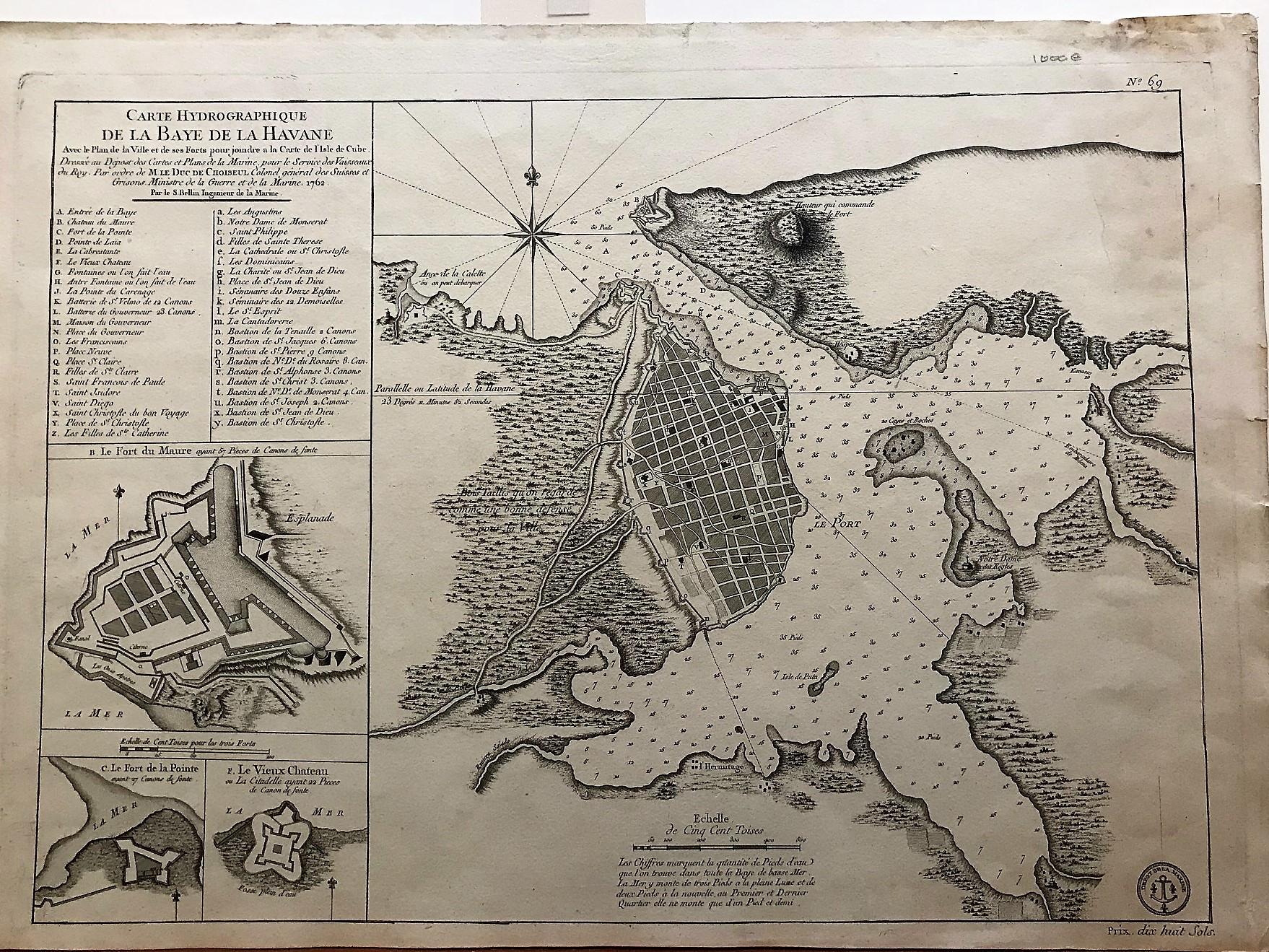
Carte hydrographique de la baye de la Havane...
Publisher: Paris
Publication Date: 1762
Binding: Sin Encuadernar
Condition: Muy bien
Store Description
We guarantee the condition of every book as it's described on the Abebooks web sites. If you're dissatisfied with your purchase (Incorrect Book/Not as Described/Damaged) or if the order hasn't arrived, you're eligible for a refund within 30 days of the estimated delivery date. If you've changed your mind about a book that you've ordered, please use the Ask bookseller a question link to contact us and we'll respond within 2 business days.
Los gastos de envío están calculados sobre la base del peso de un libro de 2.2 LB ó 1 KG. Si su pedido es demasiado grande o pesado, nosotros podemos ponernos en contacto con usted para comunicarle que gasto de envío adicional es requerido.
Payment Methods
accepted by seller
Check Bank/Wire Transfer