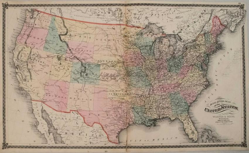
1875 Warner & Beers United States Railroad Map
Title/Content of Map: 1875 Warner & Beers United States Railroad Map -- Railroad Map of the United States
Date: 1875, ChicagoCartographer: Warner & Beers
Size: 16.5 X 28 in.
This is a very nice, rarer, double page map showing the extent of the railroad network throughout the United States. The first transcontinental railroad had only been completed five years earlier with the joining of the Central Pacific and Union Pacific Railroads. This railroad paved the way for western expansion that is illustrated here with several new spur lines already connecting the mining districts in Colorado and the agricultural and cattle regions in Nebraska and Kansas. The next transcontinental routes are shown with the northern route completed to Bismarck, North Dakota, and the southern route reaching Ft. Chadbourne, Texas. The western territories are still relatively undeveloped outside of a few forts and towns along the wagon roads.
Reserve: $220.00
Shipping:
Domestic: Flat-rate of $14.00 to anywhere within the contiguous U.S.
International: Foreign shipping rates are determined by destination.
Combined shipping: Please ask about combined shipping for multiple lots before bidding.
Location: This item ships from Ohio
Your purchase is protected:
Photos, descriptions, and estimates were prepared with the utmost care by a fully certified expert and appraiser. All items in this sale are guaranteed authentic.
In the rare event that the item did not conform to the lot description in the sale, Jasper52 specialists are here to help. Buyers may return the item for a full refund provided you notify Jasper52 within 5 days of receiving the item.
Condition Report: Good-Fair.Slight toning and soiling. Three small circular voids near the issued centerfold.Light pencil notations in the 'Atlantic Ocean'.Colored
View it on
Estimate
Time, Location
Auction House
Title/Content of Map: 1875 Warner & Beers United States Railroad Map -- Railroad Map of the United States
Date: 1875, ChicagoCartographer: Warner & Beers
Size: 16.5 X 28 in.
This is a very nice, rarer, double page map showing the extent of the railroad network throughout the United States. The first transcontinental railroad had only been completed five years earlier with the joining of the Central Pacific and Union Pacific Railroads. This railroad paved the way for western expansion that is illustrated here with several new spur lines already connecting the mining districts in Colorado and the agricultural and cattle regions in Nebraska and Kansas. The next transcontinental routes are shown with the northern route completed to Bismarck, North Dakota, and the southern route reaching Ft. Chadbourne, Texas. The western territories are still relatively undeveloped outside of a few forts and towns along the wagon roads.
Reserve: $220.00
Shipping:
Domestic: Flat-rate of $14.00 to anywhere within the contiguous U.S.
International: Foreign shipping rates are determined by destination.
Combined shipping: Please ask about combined shipping for multiple lots before bidding.
Location: This item ships from Ohio
Your purchase is protected:
Photos, descriptions, and estimates were prepared with the utmost care by a fully certified expert and appraiser. All items in this sale are guaranteed authentic.
In the rare event that the item did not conform to the lot description in the sale, Jasper52 specialists are here to help. Buyers may return the item for a full refund provided you notify Jasper52 within 5 days of receiving the item.
Condition Report: Good-Fair.Slight toning and soiling. Three small circular voids near the issued centerfold.Light pencil notations in the 'Atlantic Ocean'.Colored


