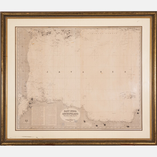
A Map of East India Archipelago Chart No. 4, 1882
A Map of East India Archipelago Chart No. 4, 1882,
Western route to China. Showing Sumatra, Java and the Java Sea.
Published: James Imray & Son, London, 1872.
Two sheets No. 1 and 2.
Framed dimensions: H: 52 3/4 x W: 61 3/4 in.
Size: H: 41 1/2 W: 50 1/4
Condition: Joined vertically. Fold marks. Creasing and foxing throughout. Plywood sheet to support back of frame. Not examined out of frame.
View it on
Estimate
Time, Location
Auction House
A Map of East India Archipelago Chart No. 4, 1882,
Western route to China. Showing Sumatra, Java and the Java Sea.
Published: James Imray & Son, London, 1872.
Two sheets No. 1 and 2.
Framed dimensions: H: 52 3/4 x W: 61 3/4 in.
Size: H: 41 1/2 W: 50 1/4
Condition: Joined vertically. Fold marks. Creasing and foxing throughout. Plywood sheet to support back of frame. Not examined out of frame.


