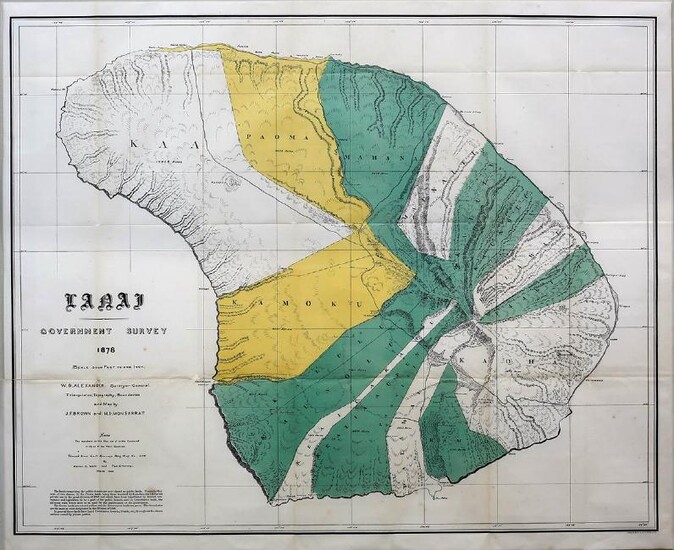
Alexander Map of Lanai, Hawaii
Alexander, W.D. (1833-1913)
Lanai Government survey 1878
Photo Lithographed Map
Philadelphia: Bien, 1878 (1901).
28 1/4" x 34 1/2" sheet, 33 1/2" x 39" framed.
This fascinating and detailed early survey of the island was made under the direction of W.D. Alexander, Surveyor General of Hawaii Territory. The triangulation, topography, and boundaries are by J.F. Brown and M.D. Monsarrat. The island is divided into at least ten regions, all named and shown via coloration, with acreages given. It locates harbors, rocks, anchorages, school houses, villages, and peaks with elevations.
View it on
Estimate
Time, Location
Auction House
Alexander, W.D. (1833-1913)
Lanai Government survey 1878
Photo Lithographed Map
Philadelphia: Bien, 1878 (1901).
28 1/4" x 34 1/2" sheet, 33 1/2" x 39" framed.
This fascinating and detailed early survey of the island was made under the direction of W.D. Alexander, Surveyor General of Hawaii Territory. The triangulation, topography, and boundaries are by J.F. Brown and M.D. Monsarrat. The island is divided into at least ten regions, all named and shown via coloration, with acreages given. It locates harbors, rocks, anchorages, school houses, villages, and peaks with elevations.


