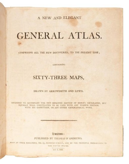
Arrowsmith & Lewis Atlas 1805
Heading:
Author: Arrowsmith, Aaron and Samuel Lewis
Title: A New and Elegant General Atlas comprising all the New Discoveries, to the present Times: containing 63 maps drawn by Arrowsmith and Lewis. Intended to accompany the New Improved Edition of Morse's Geography, but equally well calculated to be used with any former edition, with his Gazetteer or any other Geographical Work
Place Published: Boston
Publisher:Published by Thomas and Andrews
Date Published: 1805
Description:
Title page, table of contents + 63 engraved maps, 3 of them folding. (4to) 27.5x22 cm (10¾x8½"), period marbled boards backed with sheep.
Second edition of the Arrowsmith and Lewis Atlas, with the maps from the same plates as the first edition. These include the significant Louisiana (Wheat 259), British Possessions in America (Wheat 260), Spanish Dominions in North America (Wheat 261) and North America (Wheat 262) - about which Wheat says collectively "When considered together the four afford a remarkably clear epitome of the knowledge of the West at the moment when Meriwether Lewis and William Clark were poised for the take-off of their history-making expedition."
Condition Report: Binding well rubbed, corners worn; endpapers creased as is the title-page, moderate foxing and some soiling within; very good.
View it on
Sale price
Estimate
Time, Location
Auction House
Heading:
Author: Arrowsmith, Aaron and Samuel Lewis
Title: A New and Elegant General Atlas comprising all the New Discoveries, to the present Times: containing 63 maps drawn by Arrowsmith and Lewis. Intended to accompany the New Improved Edition of Morse's Geography, but equally well calculated to be used with any former edition, with his Gazetteer or any other Geographical Work
Place Published: Boston
Publisher:Published by Thomas and Andrews
Date Published: 1805
Description:
Title page, table of contents + 63 engraved maps, 3 of them folding. (4to) 27.5x22 cm (10¾x8½"), period marbled boards backed with sheep.
Second edition of the Arrowsmith and Lewis Atlas, with the maps from the same plates as the first edition. These include the significant Louisiana (Wheat 259), British Possessions in America (Wheat 260), Spanish Dominions in North America (Wheat 261) and North America (Wheat 262) - about which Wheat says collectively "When considered together the four afford a remarkably clear epitome of the knowledge of the West at the moment when Meriwether Lewis and William Clark were poised for the take-off of their history-making expedition."
Condition Report: Binding well rubbed, corners worn; endpapers creased as is the title-page, moderate foxing and some soiling within; very good.


