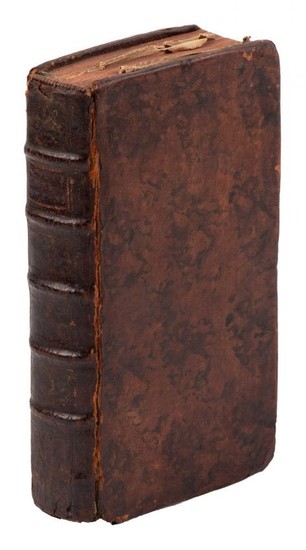
Atlas des Enfans 1778
Heading: (Atlas des Enfans)
Author: [Schneider, J.H.].
Title: Atlas des Enfans, ou Nouvelle Méthode pour apprendre La Géographie, avec un Nouveau Traité dé la Sphere, et XXIV Cartes Enluminées [bound with, as issued] Nouveau Traité de la Sphere
Place Published: Lyon
Publisher:Chez Jean-Marie Bruyset Pere & Fils
Date Published: 1778
Description:
xii, 360, 60, [4] pp. With engraved frontispiece & 20 (of 22) folding engraved maps in the 1st work; 2 folding engraved plates in the 2nd work. (8vo) 16.5x9 cm (6½x3½"), period mottled calf, raised spine bands, morocco label.
Later edition, likely pirated, of this children's introduction to geography and astronomy, many times reprinted and pirated. The maps are "blind" maps, with the outlines of continents, countries etc. only so children learn to find them by reading the text. Europe, Asia, Africa, and North and South America are covered, but not Australia or the Poles. The second part introduces children to globes and their usage, and principles of cosmography and astronomy.
Condition Report: Darkening to spine, wear at ends; some internal foxing and soiling, lacking the maps that should face pages 42 and 271 in the first work; good to very good.
View it on
Sale price
Estimate
Time, Location
Auction House
Heading: (Atlas des Enfans)
Author: [Schneider, J.H.].
Title: Atlas des Enfans, ou Nouvelle Méthode pour apprendre La Géographie, avec un Nouveau Traité dé la Sphere, et XXIV Cartes Enluminées [bound with, as issued] Nouveau Traité de la Sphere
Place Published: Lyon
Publisher:Chez Jean-Marie Bruyset Pere & Fils
Date Published: 1778
Description:
xii, 360, 60, [4] pp. With engraved frontispiece & 20 (of 22) folding engraved maps in the 1st work; 2 folding engraved plates in the 2nd work. (8vo) 16.5x9 cm (6½x3½"), period mottled calf, raised spine bands, morocco label.
Later edition, likely pirated, of this children's introduction to geography and astronomy, many times reprinted and pirated. The maps are "blind" maps, with the outlines of continents, countries etc. only so children learn to find them by reading the text. Europe, Asia, Africa, and North and South America are covered, but not Australia or the Poles. The second part introduces children to globes and their usage, and principles of cosmography and astronomy.
Condition Report: Darkening to spine, wear at ends; some internal foxing and soiling, lacking the maps that should face pages 42 and 271 in the first work; good to very good.


