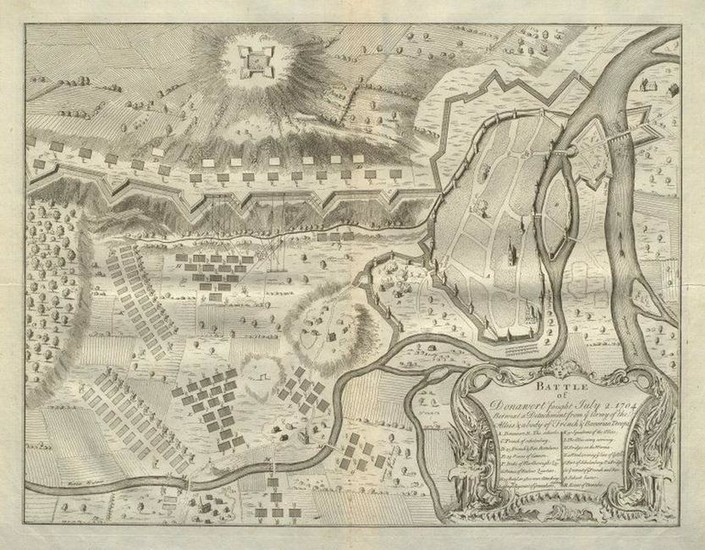
Battle of Donawert, July 2, 1704.
TITLE/CONTENT OF MAP: 'Battle of Donawert fought July 2, 1704 betwixt a detachment from ye Army of the Allies & a body of French & Bavarian Troops'
DATE PRINTED: 1736
IMAGE SIZE: Approx 35.0 x 44.5cm, 13.75 x 17.5 inches (Large); Please note that this is a folding map.
TYPE: Antique 18th century copperplate map
CONDITION: Good; suitable for framing. Please check the scan for any blemishes prior to making your purchase. Virtually all antiquarian maps and prints are subject to some normal aging due to use and time which is not obtrusive unless otherwise stated.
AUTHENTICITY: This is an authentic historic map, published at the date stated above. It is not a modern copy.
VERSO: There is nothing printed on the reverse side, which is plain
FOLDING: This is a folding map.
ARTIST/CARTOGRAPHER/ENGRAVER: Claude du Bosc
PROVENANCE: "The Military History of the Late Prince Eugene of Savoy and the Late John Duke of Marlborough &c. Volume I", by Claude du Bosc, London, printed by James Bettenham for Claude du Bosc, engraver at the Golden Head in Charles Street, Covent Garden MDCCXXXVI
Reserve: $215.00
Shipping:
Domestic: Flat-rate of $23.00 to anywhere within the contiguous U.S.
International: Foreign shipping rates are determined by destination.
Combined shipping: Please ask about combined shipping for multiple lots before bidding.
Location: This item ships from United Kingdom.
Your purchase is protected:
Photos, descriptions, and estimates were prepared with the utmost care by a fully certified expert and appraiser. All items in this sale are guaranteed authentic.
In the rare event that the item did not conform to the lot description in the sale, Jasper52 specialists are here to help. Buyers may return the item for a full refund provided you notify Jasper52 within 5 days of receiving the item.
View it on
Estimate
Time, Location
Auction House
TITLE/CONTENT OF MAP: 'Battle of Donawert fought July 2, 1704 betwixt a detachment from ye Army of the Allies & a body of French & Bavarian Troops'
DATE PRINTED: 1736
IMAGE SIZE: Approx 35.0 x 44.5cm, 13.75 x 17.5 inches (Large); Please note that this is a folding map.
TYPE: Antique 18th century copperplate map
CONDITION: Good; suitable for framing. Please check the scan for any blemishes prior to making your purchase. Virtually all antiquarian maps and prints are subject to some normal aging due to use and time which is not obtrusive unless otherwise stated.
AUTHENTICITY: This is an authentic historic map, published at the date stated above. It is not a modern copy.
VERSO: There is nothing printed on the reverse side, which is plain
FOLDING: This is a folding map.
ARTIST/CARTOGRAPHER/ENGRAVER: Claude du Bosc
PROVENANCE: "The Military History of the Late Prince Eugene of Savoy and the Late John Duke of Marlborough &c. Volume I", by Claude du Bosc, London, printed by James Bettenham for Claude du Bosc, engraver at the Golden Head in Charles Street, Covent Garden MDCCXXXVI
Reserve: $215.00
Shipping:
Domestic: Flat-rate of $23.00 to anywhere within the contiguous U.S.
International: Foreign shipping rates are determined by destination.
Combined shipping: Please ask about combined shipping for multiple lots before bidding.
Location: This item ships from United Kingdom.
Your purchase is protected:
Photos, descriptions, and estimates were prepared with the utmost care by a fully certified expert and appraiser. All items in this sale are guaranteed authentic.
In the rare event that the item did not conform to the lot description in the sale, Jasper52 specialists are here to help. Buyers may return the item for a full refund provided you notify Jasper52 within 5 days of receiving the item.


