Everything Is Bigger in Texas, "Official Texas Brags Map of North America"
Subject: Texas, North America
Period: 1967 (dated)
Color: Printed Color
Size: 16.8 x 22.1
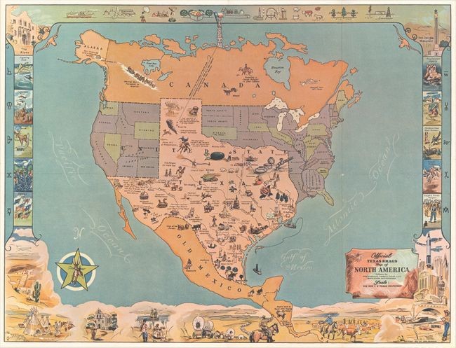
This humorous map of North America was drawn with a vastly oversized Texas occupying approximately half of the United States. The eastern part of the United States is playfully identified as "Unannexed Territory" and the western portion is "Ceded Territory." Texas is filled with illustrations and amusing text including "1 Texas inch Equals 2 Feet", "True location of North Pole - 36.04 mi due North of Amarillo", and "Beefiest Turkeys" to name a few. Surrounding the map image are a series of related vignettes including the Alamo, San Jacinto Monument, and "Rowdy Rodeos." Drawn and illustrated by Mark Storm and published by John Randolph. This is the second edition of this map, first published in 1948, with the date and publisher's imprint updated. The map is accompanied by its original mailing envelope.
Condition: A
A clean, colorful example with a couple of tiny holes at fold intersections. Issued folding. The envelope is lightly toned with a 1" tear at bottom right.
View it on
Sale price
Estimate
Time, Location
Auction House
Subject: Texas, North America
Period: 1967 (dated)
Color: Printed Color
Size: 16.8 x 22.1
This humorous map of North America was drawn with a vastly oversized Texas occupying approximately half of the United States. The eastern part of the United States is playfully identified as "Unannexed Territory" and the western portion is "Ceded Territory." Texas is filled with illustrations and amusing text including "1 Texas inch Equals 2 Feet", "True location of North Pole - 36.04 mi due North of Amarillo", and "Beefiest Turkeys" to name a few. Surrounding the map image are a series of related vignettes including the Alamo, San Jacinto Monument, and "Rowdy Rodeos." Drawn and illustrated by Mark Storm and published by John Randolph. This is the second edition of this map, first published in 1948, with the date and publisher's imprint updated. The map is accompanied by its original mailing envelope.
Condition: A
A clean, colorful example with a couple of tiny holes at fold intersections. Issued folding. The envelope is lightly toned with a 1" tear at bottom right.


