Faden Map of New York, 1776
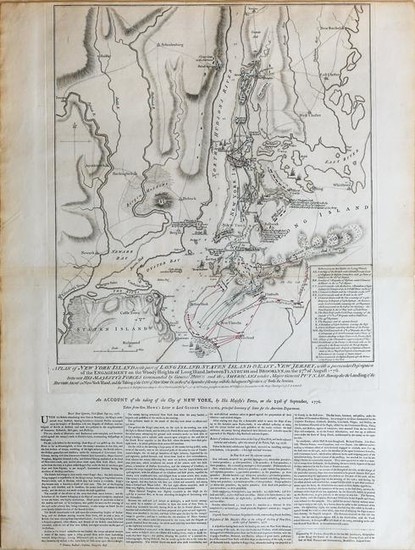
FADEN, William (1749-1836).
A Plan of New York Island, with part of Long Island, Staten Island & East New Jersey.
Engraved map.
London: William Faden, October 19th, 1776.
26 3/4" x 21 3/4" sheet, 39" x 32" framed.
The most accurate Revolutionary War battle map.
A Magnificent example of state 3 (of 5 states), this issue on large paper with the four columns of text relating to the attack on long Island beneath the plan. The map shows the movements of the opposing American and British armies through the time of the disembarkment of the British army on September 15, 1776. Faden's map was printed only five weeks after the battle, much like an updated bulletin. It details all of the day's events with increadible moment-tomoment precision.
View it on
Sale price
Estimate
Time, Location
Auction House
FADEN, William (1749-1836).
A Plan of New York Island, with part of Long Island, Staten Island & East New Jersey.
Engraved map.
London: William Faden, October 19th, 1776.
26 3/4" x 21 3/4" sheet, 39" x 32" framed.
The most accurate Revolutionary War battle map.
A Magnificent example of state 3 (of 5 states), this issue on large paper with the four columns of text relating to the attack on long Island beneath the plan. The map shows the movements of the opposing American and British armies through the time of the disembarkment of the British army on September 15, 1776. Faden's map was printed only five weeks after the battle, much like an updated bulletin. It details all of the day's events with increadible moment-tomoment precision.

![[CARTE]. William FADEN. [CARTE]. William FADEN.](https://gcp-la8-storage-cdn.lot-art.com/public/upl/52/CARTE-William-FADEN_6621af9591b17-thumb-55980200_1713483670-6621af9688ac8.jpg)
![[Netherlands]. "A Map of the Seven United Provinces, with the... [Netherlands]. "A Map of the Seven United Provinces, with the...](https://gcp-la8-storage-cdn.lot-art.com/public/upl/9/Netherlands-A-Map-of-the-Seven-United-Provinces-with-the_6629482aa5029-thumb-23072200_1713981483-6629482b3854f.jpg)


