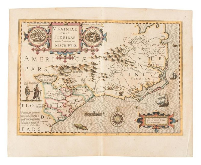
Hondius map of Virginia 1619
Heading:
Author: Hondius, Jodocus
Title: Virginiae Item et Floridae Americae Provinciarum, Nova Descriptio
Place Published: Amsterdam
Publisher:
Date Published: 1606-[1619]
Description:
Copper-engraved map, hand-colored. 34.1x48.3 cm. (13½x19").
Hondius' landmark map of 1606, this example issued in 1619, which was the only regional map of North America in the first edition of the Mercator-Hondius atlas. Burden notes it is "a composite largely of John White's Virginia and Jacques le Moyne's Florida as interpreted by Thedore de Bry in 1590 and 1591 respectively. Chesepioock Sinus representing Chesapeake Bay is still shown in its White delineation. At the end of this years, 1606, a party of Englishmen left England to begin arguably the most important colonization of North America in this very bay, at Jamestown. Within just a few years the entire region would be complete revised cartographically... The map is embellished with various game including a wild turkey. Examples of Indian villages in Florida and Virginia appear in cartouches either side of the title. The map's scale and decorativeness make it very sought after..." This 1619 issue can be dated from the French text on the verso and the signature mark Dddddddd. Burden 151; Cumming 26.
Condition Report: Light and fairly unobtrusive dampstains at sides and bottom of map image; very good overall.
View it on
Sale price
Estimate
Time, Location
Auction House
Heading:
Author: Hondius, Jodocus
Title: Virginiae Item et Floridae Americae Provinciarum, Nova Descriptio
Place Published: Amsterdam
Publisher:
Date Published: 1606-[1619]
Description:
Copper-engraved map, hand-colored. 34.1x48.3 cm. (13½x19").
Hondius' landmark map of 1606, this example issued in 1619, which was the only regional map of North America in the first edition of the Mercator-Hondius atlas. Burden notes it is "a composite largely of John White's Virginia and Jacques le Moyne's Florida as interpreted by Thedore de Bry in 1590 and 1591 respectively. Chesepioock Sinus representing Chesapeake Bay is still shown in its White delineation. At the end of this years, 1606, a party of Englishmen left England to begin arguably the most important colonization of North America in this very bay, at Jamestown. Within just a few years the entire region would be complete revised cartographically... The map is embellished with various game including a wild turkey. Examples of Indian villages in Florida and Virginia appear in cartouches either side of the title. The map's scale and decorativeness make it very sought after..." This 1619 issue can be dated from the French text on the verso and the signature mark Dddddddd. Burden 151; Cumming 26.
Condition Report: Light and fairly unobtrusive dampstains at sides and bottom of map image; very good overall.


