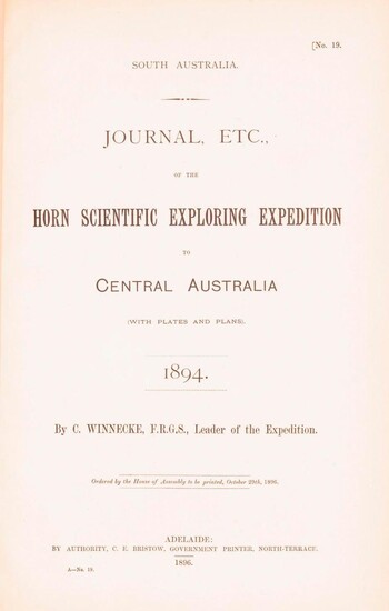
Journal . of the Horn Scientific Exploring Expedition to Central Australia . 1894
By WINNECKE, Charles
Adelaide, Government Printer, 1896. Foolscap folio, 32 pages (including Appendix B: Report of the Physical Geography of Central Australia, by Professor R. Tate and J.A. Watt) plus 24 plates on 13 leaves (printed rectos only) and a folding meteorological chart, 2 folding maps (a topographical map of Mount Watt and a Survey of Hermannsburg Mission Station), and a very large folding colour map (1210 × 1210 mm). Recent cloth with lettering on the front cover; blank bottom margin of the main map slightly creased with one tiny tear expertly sealed; a fine copy. South Australian Parliamentary Paper 19 of 1896: only 650 copies printed. Winnecke was the leader of the expedition, and in 'the natural order of things these [journals and maps] should have been published in connection with the scientific and other records of the Horn Expedition, as both supplementary and complementary to them'. After a financial disagreement with W.A. Horn (the organiser and backer of the venture) this did not occur, and this first edition was published under the auspices of the South Australian branch of the Royal Geographical Society of Australasia in conjunction with the Department of the Minister for the Northern Territory and the Survey Department. McLaren 16973; an octavo edition was published the following year (see McLaren 16969 - not noting the very large map).
Published by: Government Printer, Adelaide, 1896
Vendor: Michael Treloar Booksellers ANZAAB/ILAB
Buy Now on
By WINNECKE, Charles
Adelaide, Government Printer, 1896. Foolscap folio, 32 pages (including Appendix B: Report of the Physical Geography of Central Australia, by Professor R. Tate and J.A. Watt) plus 24 plates on 13 leaves (printed rectos only) and a folding meteorological chart, 2 folding maps (a topographical map of Mount Watt and a Survey of Hermannsburg Mission Station), and a very large folding colour map (1210 × 1210 mm). Recent cloth with lettering on the front cover; blank bottom margin of the main map slightly creased with one tiny tear expertly sealed; a fine copy. South Australian Parliamentary Paper 19 of 1896: only 650 copies printed. Winnecke was the leader of the expedition, and in 'the natural order of things these [journals and maps] should have been published in connection with the scientific and other records of the Horn Expedition, as both supplementary and complementary to them'. After a financial disagreement with W.A. Horn (the organiser and backer of the venture) this did not occur, and this first edition was published under the auspices of the South Australian branch of the Royal Geographical Society of Australasia in conjunction with the Department of the Minister for the Northern Territory and the Survey Department. McLaren 16973; an octavo edition was published the following year (see McLaren 16969 - not noting the very large map).
Published by: Government Printer, Adelaide, 1896
Vendor: Michael Treloar Booksellers ANZAAB/ILAB


