MAP, Central US, Whipple
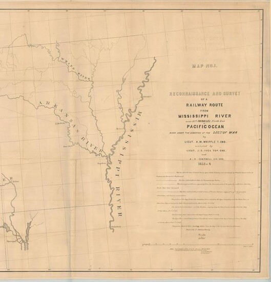
Central United States. Amiel Weekes Whipple, Map No. 1. Reconnaissance and Survey of a Railway Route from Mississippi River Near 35th Parallel North Lat. to Pacific Ocean..., from U.S. Pacific Railroad Surveys, 1853-54 (dated). Black & White. This mammoth map is the result of the explorations and surveys of Lieut. A.W. Whipple and Lieut. J.C. Ives, Topographical Engineers, and A.H. Campbell, Civil Engineer that was issued as part of a two-map set. Wheat says Whipple "had demonstrated that the route which he had surveyed was practicable for a railroad, and the Santa Fe Railroad now traverses much of it … This is an important map, in its two parts, and reflects great credit upon Whipple and his entire party." This map extends from the vicinity of Memphis and Vicksburg to the Rio Grande valley at Santa Fe and Albuquerque. Locates forts Arbuckle, Washita, Smith and numerous Indian villages. The second map (not present) continues on to Los Angeles. Drawn by A. Schimmelfinnig. An uncommon map that has been stabilized with linen and encased in Mylar for preservation.
Dimensions: 26.4 x 80.3 in
Condition Report: Issued folding and now flattened and backed with linen to reinforce and repair numerous small splits at the junctions with some minor loss. There are 7" and 5" separations at right that are no longer glued down to the linen. Light toning and offsetting. Grade: B
View it on
Estimate
Time, Location
Auction House
Central United States. Amiel Weekes Whipple, Map No. 1. Reconnaissance and Survey of a Railway Route from Mississippi River Near 35th Parallel North Lat. to Pacific Ocean..., from U.S. Pacific Railroad Surveys, 1853-54 (dated). Black & White. This mammoth map is the result of the explorations and surveys of Lieut. A.W. Whipple and Lieut. J.C. Ives, Topographical Engineers, and A.H. Campbell, Civil Engineer that was issued as part of a two-map set. Wheat says Whipple "had demonstrated that the route which he had surveyed was practicable for a railroad, and the Santa Fe Railroad now traverses much of it … This is an important map, in its two parts, and reflects great credit upon Whipple and his entire party." This map extends from the vicinity of Memphis and Vicksburg to the Rio Grande valley at Santa Fe and Albuquerque. Locates forts Arbuckle, Washita, Smith and numerous Indian villages. The second map (not present) continues on to Los Angeles. Drawn by A. Schimmelfinnig. An uncommon map that has been stabilized with linen and encased in Mylar for preservation.
Dimensions: 26.4 x 80.3 in
Condition Report: Issued folding and now flattened and backed with linen to reinforce and repair numerous small splits at the junctions with some minor loss. There are 7" and 5" separations at right that are no longer glued down to the linen. Light toning and offsetting. Grade: B


