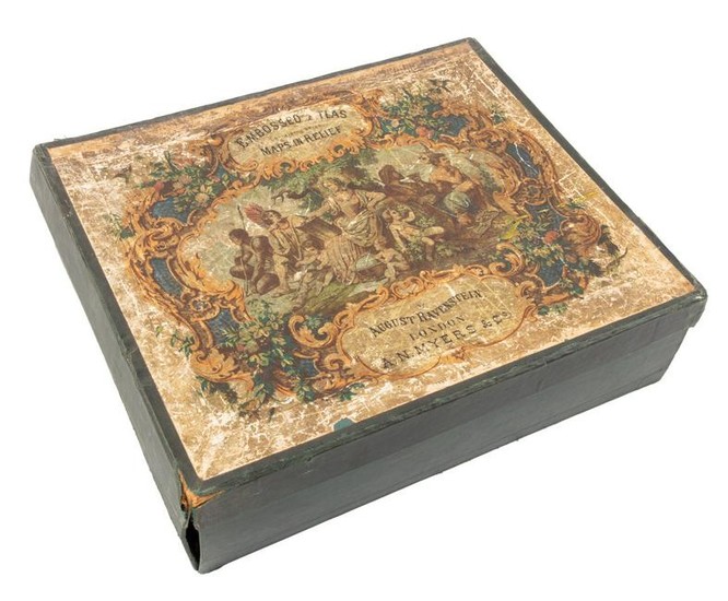
Relief maps of continents with box, c.1880
Heading:
Author: Ravenstein, August
Title: Embossed Atlas for Elementary Instruction in Physical Geography. Containing Maps of Europe, Asia, Africa, North America, South America, Australasia and Polynesia, together with an Ideal Picture of the Physical Geography of the World; Executed in Relief, and printed in Colours
Place Published: London
Publisher:A.N. Myers & Co.
Date Published: c.1880
Description:
Seven color maps in relief, each in frame measuring 23.5x28 cm (9¼x11") including the frame. Accompanied by a paper folder containing a corresponding set of maps printed in colors showing political boundaries. All set loose in original cloth-covered drop-front box with folding lid, titled on inside of lid which also has a color key; color lithographed paper label on outside of lid shows peoples representing the continents. Box measures 24.5x29.4x8 cm (9¾x11½x3¼").
Rare set of relief maps of the continents, and the Pacific, in the original box. OCLC lists two examples, one at the Universiteit Utrecht (dated 1875, with no mention of a box), and one at Princeton University (dated "before 1889", with the box).
Condition Report: Wear to box extremities, a few creases to sides, color label well scratched and worn; paper folder for the printed maps split along fold; relief maps with just a touch of wear; very good.
View it on
Sale price
Estimate
Time, Location
Auction House
Heading:
Author: Ravenstein, August
Title: Embossed Atlas for Elementary Instruction in Physical Geography. Containing Maps of Europe, Asia, Africa, North America, South America, Australasia and Polynesia, together with an Ideal Picture of the Physical Geography of the World; Executed in Relief, and printed in Colours
Place Published: London
Publisher:A.N. Myers & Co.
Date Published: c.1880
Description:
Seven color maps in relief, each in frame measuring 23.5x28 cm (9¼x11") including the frame. Accompanied by a paper folder containing a corresponding set of maps printed in colors showing political boundaries. All set loose in original cloth-covered drop-front box with folding lid, titled on inside of lid which also has a color key; color lithographed paper label on outside of lid shows peoples representing the continents. Box measures 24.5x29.4x8 cm (9¾x11½x3¼").
Rare set of relief maps of the continents, and the Pacific, in the original box. OCLC lists two examples, one at the Universiteit Utrecht (dated 1875, with no mention of a box), and one at Princeton University (dated "before 1889", with the box).
Condition Report: Wear to box extremities, a few creases to sides, color label well scratched and worn; paper folder for the printed maps split along fold; relief maps with just a touch of wear; very good.


