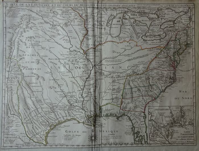
U.S., Colonial Eastern United States, Louisiana Territory; Delisle / Dezauche - Carte de la Louisiane et du Cours du Mississipi avec les Colonies Anglaises - 1782
Condition: good. Some cracks in the edge. Fold as issued, there are on the left creases. Pinhole on the right below. Mounted on old-time atlas paper. Verso: blank When originally published in 1718, it was the first detailed map of the Gulf region and the Mississippi, and the first to show the explorations of De Soto, Cavelier, Tonty, Moscoso and Denis. The name Texas made its first appearance in print on this map. The notation of Indiens errans nommes Chetis along the Gulf Coast is changed from the earlier editions, which noted that they were anthrophages, or cannibals. An inset of the Mississippi Delta and Mobile Bay fills the lower right corner. This is the Dezauche edition, showing the settlement of New Orleans, founded 1718.
[ translate ]View it on
Estimate
Time, Location
Auction House
Condition: good. Some cracks in the edge. Fold as issued, there are on the left creases. Pinhole on the right below. Mounted on old-time atlas paper. Verso: blank When originally published in 1718, it was the first detailed map of the Gulf region and the Mississippi, and the first to show the explorations of De Soto, Cavelier, Tonty, Moscoso and Denis. The name Texas made its first appearance in print on this map. The notation of Indiens errans nommes Chetis along the Gulf Coast is changed from the earlier editions, which noted that they were anthrophages, or cannibals. An inset of the Mississippi Delta and Mobile Bay fills the lower right corner. This is the Dezauche edition, showing the settlement of New Orleans, founded 1718.
[ translate ]


