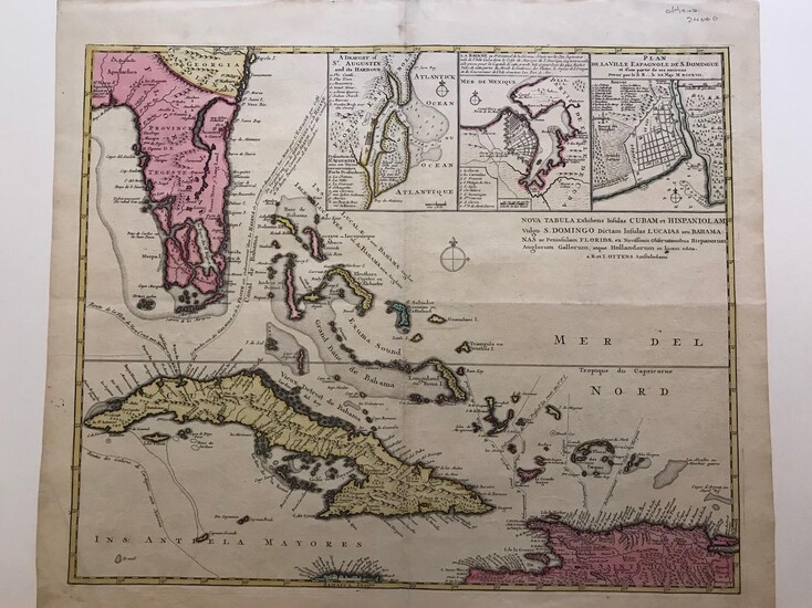
Nova Tabula Exhibens Insulas Cubam et Hispaniolam vulgo S. Domingo Dictam Insulas Lucaias seu Bahamanas ac Peninsulam Floridae ex Novissimis Observationibus Hispanorum Anglorum Gallorum, et atque Hollandorum in lucem edita.
By Ottens, Reiner and Joshua
Copper engraved map with original hand colour.59 x 53 cms. This map is part of a large scale map that represented the Caribbean sea during the war of Jenkin´s ear in 1740-41. The map details the route of the spanish silver galleons fleets that departed from Havana on route to Seville.The map contains three insets with Saint Agustin ( Florida), Havana harbour and St Domingue( Hispaniola). Map in fine condition.
Published by: Amsterdam, 1740
Vendor: Libreria Pontes
Buy Now on
By Ottens, Reiner and Joshua
Copper engraved map with original hand colour.59 x 53 cms. This map is part of a large scale map that represented the Caribbean sea during the war of Jenkin´s ear in 1740-41. The map details the route of the spanish silver galleons fleets that departed from Havana on route to Seville.The map contains three insets with Saint Agustin ( Florida), Havana harbour and St Domingue( Hispaniola). Map in fine condition.
Published by: Amsterdam, 1740
Vendor: Libreria Pontes


