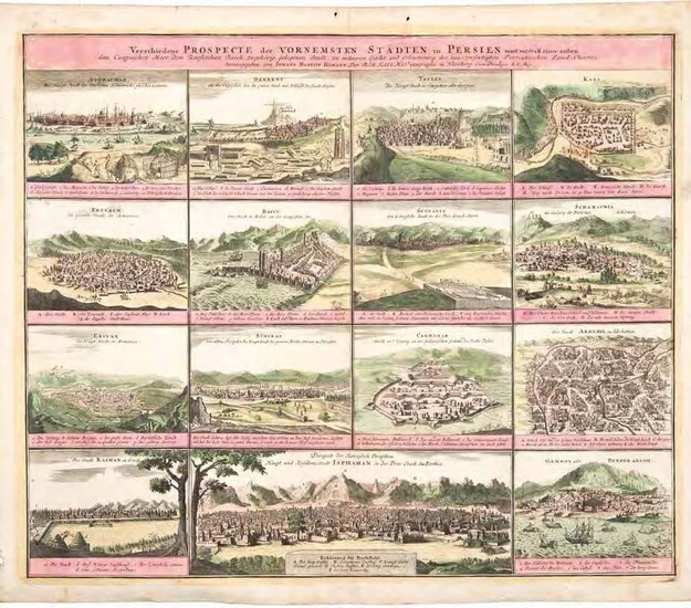
Verschiedene Prospekte der vornemsten Städten in Persien.
By Homann, Johann Baptist, map-maker (1663-1724).Birds-eye views of the chief cities of the Persian Empire under the Safavid dynasty.
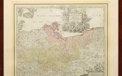
Engraving comprising 15 aerial city views with captions in German below. Original wash colour: images in green, text panels in pink, surrounding border in yellow. Image size: 49 x 58 cm; overall size: 53.5 x 62.5 cm. Fifteen views of prominent cities within the former Persian Empire arranged on one sheet, including Astrachan (Astrakhan, southern Russia), Derbent (Dagestan), Teflis (Tbilisi, Georgia), Kars (northeastern Turkey), Erzerum (Erzurum, northeastern Turkey), Baccu (Baku, Azerbaijan), Sultania (Soltaniyeh, Iran), Schmachia (Shamakha, Azerbaijan), Erivan (Yerevan, Armenia), Schiraz (Shiraz, Iran), Candahar (Kandahar, Afghanistan), Ardebii (Aardabil, Iran), Kachan (Kashan, Iran), Isphahan (Esfahan, Iran);Gamron / Bender Abassi (Bandar Abbas, Iran). Isfahan is shown considerably larger than the other cities as the actual capital of the Empire. Shiraz is identified as the ancient city of Persepolis, a former capital. Below each view are indicated the principal points of interest such as city gates and walls, rivers, royal palaces, and markets. The Safavids controlled the area of modern Iran, Azerbaijan, Armenia, Afghanistan, most of Georgia, and parts of Turkey. Homann was the outstanding German map publisher in the 18th century. Very well preserved; 2 tiny holes in top blank margin.
Published by: Nuremberg [1762]., 1762
Vendor: Hünersdorff Rare Books ABA ILAB
Buy Now on
By Homann, Johann Baptist, map-maker (1663-1724).Birds-eye views of the chief cities of the Persian Empire under the Safavid dynasty.
Engraving comprising 15 aerial city views with captions in German below. Original wash colour: images in green, text panels in pink, surrounding border in yellow. Image size: 49 x 58 cm; overall size: 53.5 x 62.5 cm. Fifteen views of prominent cities within the former Persian Empire arranged on one sheet, including Astrachan (Astrakhan, southern Russia), Derbent (Dagestan), Teflis (Tbilisi, Georgia), Kars (northeastern Turkey), Erzerum (Erzurum, northeastern Turkey), Baccu (Baku, Azerbaijan), Sultania (Soltaniyeh, Iran), Schmachia (Shamakha, Azerbaijan), Erivan (Yerevan, Armenia), Schiraz (Shiraz, Iran), Candahar (Kandahar, Afghanistan), Ardebii (Aardabil, Iran), Kachan (Kashan, Iran), Isphahan (Esfahan, Iran);Gamron / Bender Abassi (Bandar Abbas, Iran). Isfahan is shown considerably larger than the other cities as the actual capital of the Empire. Shiraz is identified as the ancient city of Persepolis, a former capital. Below each view are indicated the principal points of interest such as city gates and walls, rivers, royal palaces, and markets. The Safavids controlled the area of modern Iran, Azerbaijan, Armenia, Afghanistan, most of Georgia, and parts of Turkey. Homann was the outstanding German map publisher in the 18th century. Very well preserved; 2 tiny holes in top blank margin.
Published by: Nuremberg [1762]., 1762
Vendor: Hünersdorff Rare Books ABA ILAB
