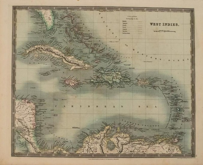
1831 Teesdale Map of Caribbean -- West Indies
Title/Content of Map: 1831 Teesdale Map of Caribbean -- West Indies
Date: 1831, London
Cartographer: H Teesdale
Size: 13.2 X 16.1 in.
This very nice map of the Caribbean / West Indies plus southern Florida, parts of Central America and the northern reaches of South America.The islands are color-coded as to whose pocessions they are - British, Spanish, French, Dutch, Danish or Swedish.The few Independent island nations are notes as well.Plenty of additional details are offered as to topography, rivers, lakes, shoals, banks, etc.From A New General Atlas of the World.Teesdale maps are increasingly scarce.
Reserve: $90.00
Shipping:
Domestic: Flat-rate of $14.00 to anywhere within the contiguous U.S.
International: Foreign shipping rates are determined by destination.
Combined shipping: Please ask about combined shipping for multiple lots before bidding.
Location: This item ships from Ohio
Your purchase is protected:
Photos, descriptions, and estimates were prepared with the utmost care by a fully certified expert and appraiser. All items in this sale are guaranteed authentic.
In the rare event that the item did not conform to the lot description in the sale, Jasper52 specialists are here to help. Buyers may return the item for a full refund provided you notify Jasper52 within 5 days of receiving the item.
Condition Report: Very Good.Nice strike on watermarked paper. Slight soiling.Original hand-color.
View it on
Estimate
Time, Location
Auction House
Title/Content of Map: 1831 Teesdale Map of Caribbean -- West Indies
Date: 1831, London
Cartographer: H Teesdale
Size: 13.2 X 16.1 in.
This very nice map of the Caribbean / West Indies plus southern Florida, parts of Central America and the northern reaches of South America.The islands are color-coded as to whose pocessions they are - British, Spanish, French, Dutch, Danish or Swedish.The few Independent island nations are notes as well.Plenty of additional details are offered as to topography, rivers, lakes, shoals, banks, etc.From A New General Atlas of the World.Teesdale maps are increasingly scarce.
Reserve: $90.00
Shipping:
Domestic: Flat-rate of $14.00 to anywhere within the contiguous U.S.
International: Foreign shipping rates are determined by destination.
Combined shipping: Please ask about combined shipping for multiple lots before bidding.
Location: This item ships from Ohio
Your purchase is protected:
Photos, descriptions, and estimates were prepared with the utmost care by a fully certified expert and appraiser. All items in this sale are guaranteed authentic.
In the rare event that the item did not conform to the lot description in the sale, Jasper52 specialists are here to help. Buyers may return the item for a full refund provided you notify Jasper52 within 5 days of receiving the item.
Condition Report: Very Good.Nice strike on watermarked paper. Slight soiling.Original hand-color.


