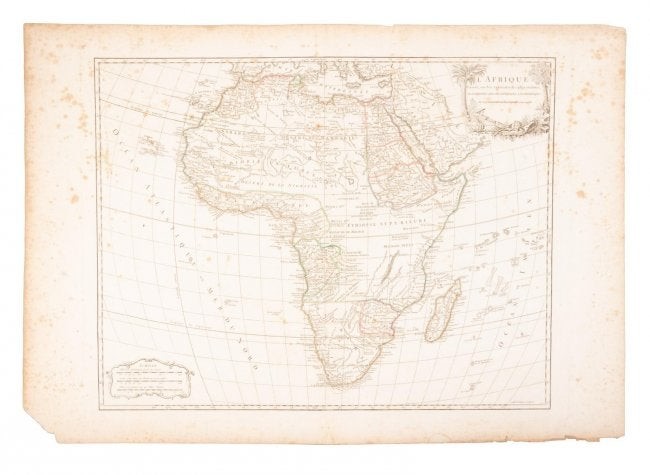
18th c. map of Africa showing known kingdoms
Heading:
Author: Robert de Vaugondy, Gilles and Didier
Title: L'Afrique dressée, sur les relations les plus recentes, et assujettie aux observations astronomiques
Place Published: [Paris]
Publisher:
Date Published: [1756]
Description:
Copper-engraved map, hand-colored in outline; uncolored pictorial cartouche. 46.4x58.5 cm. (18¼x23").
The whole of Africa at the middle of the 18th century, divided into such kingdoms as were known, the Niger River curling southward but petering out in the "Desert de la Nigrieie."
Condition Report: Margins foxed, intruding into the map, most notably the Atlantic Ocean, some wear at top and bottom of centerfold, lower left corner of margin missing, well away from the map, some mild creasing, very good.
View it on
Estimate
Time, Location
Auction House
Heading:
Author: Robert de Vaugondy, Gilles and Didier
Title: L'Afrique dressée, sur les relations les plus recentes, et assujettie aux observations astronomiques
Place Published: [Paris]
Publisher:
Date Published: [1756]
Description:
Copper-engraved map, hand-colored in outline; uncolored pictorial cartouche. 46.4x58.5 cm. (18¼x23").
The whole of Africa at the middle of the 18th century, divided into such kingdoms as were known, the Niger River curling southward but petering out in the "Desert de la Nigrieie."
Condition Report: Margins foxed, intruding into the map, most notably the Atlantic Ocean, some wear at top and bottom of centerfold, lower left corner of margin missing, well away from the map, some mild creasing, very good.


