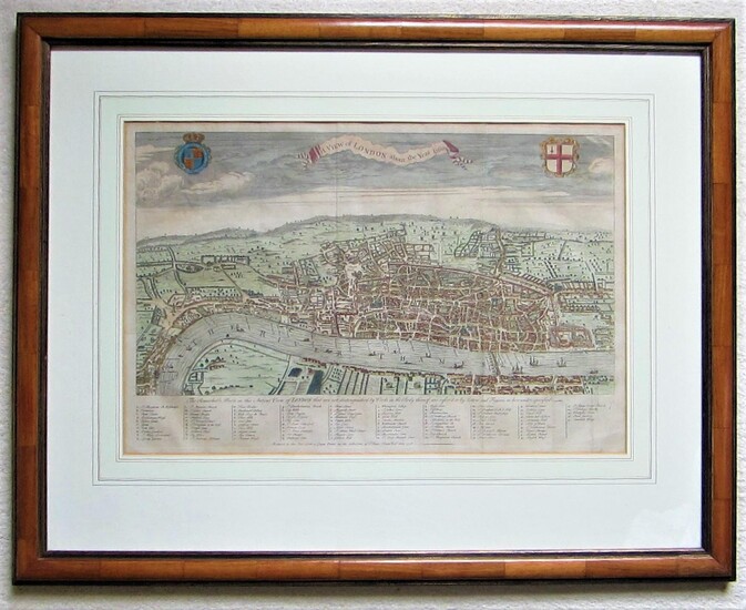
A View of London about the Year 1560. Reduced to this Size from a Large Print in the collection of Sir Hans Sloane Bart. 1738.
By Maitland, William (c.1693-1757)
An iconic plan of London at the time of Elizabeth I. copper engraved map with old hand colouring. wooden frame 55 x 70 cm. some wear and tear, o/w vg cond. platesize 31 x 47 cm. folds as issued; some slight browning; o/w vg cond. This map of London was published as frontispice to Volume I of William Maitland s History of London . As quoted on the map, this is a derivative of a larger map in the collection of Sir Hans Sloane, to be believed from a woodcut map attributed to Ralph Agas, and copied for the Society of Antiquaries in 1737. The map gives a marvellous impression of Elizabethan London, with a key identifying 80 streets and places of interest. The title is in a banner-like cartouche, surrounded with coat-of-arms of the City of London and the Royal crest. Howgego 8b However, some details in the map, such as the delineation of Lambeth Palace, are reminiscent of the so-called Copperplate Map : the oldest printed map of the city of which no complete copy has survived , and on which both the Agas view and the Braun & Hogenberg s 1724 map were based.
Published by: London, 1738
Vendor: Angelika C. J. Friebe Ltd. - MapWoman
Buy Now on
By Maitland, William (c.1693-1757)
An iconic plan of London at the time of Elizabeth I. copper engraved map with old hand colouring. wooden frame 55 x 70 cm. some wear and tear, o/w vg cond. platesize 31 x 47 cm. folds as issued; some slight browning; o/w vg cond. This map of London was published as frontispice to Volume I of William Maitland s History of London . As quoted on the map, this is a derivative of a larger map in the collection of Sir Hans Sloane, to be believed from a woodcut map attributed to Ralph Agas, and copied for the Society of Antiquaries in 1737. The map gives a marvellous impression of Elizabethan London, with a key identifying 80 streets and places of interest. The title is in a banner-like cartouche, surrounded with coat-of-arms of the City of London and the Royal crest. Howgego 8b However, some details in the map, such as the delineation of Lambeth Palace, are reminiscent of the so-called Copperplate Map : the oldest printed map of the city of which no complete copy has survived , and on which both the Agas view and the Braun & Hogenberg s 1724 map were based.
Published by: London, 1738
Vendor: Angelika C. J. Friebe Ltd. - MapWoman


