Antique Print-SEA CHART-BARENTS SEA-NORWAY-SVALBARD-NOVA ZEMBLA-Seller-Moll-1671
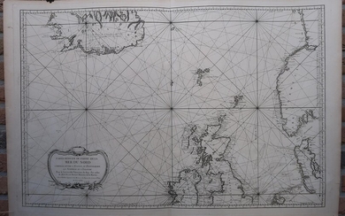
Antique print, titled: 'A New Generall Chart of the Coast of ye Northern Ocean Vitz Norway, Greenland, Finnmark, Lapland, Moscovy and Nova Zembla.' - Sea chart of the Barents Sea with the coasts of Norway, Lapland, Russia, Nova Zembla and Svalbard (wrongly named Greenland in the map's title). Numerous places along the coast are named, and an inset map details the region around Archangelsk (with depth soundings). Two compass roses and rhumb lines. Description: From John Seller's "The English Pilot", an English sea atlas published from 1671 to 1803. This atlas was published by Mount & Page of London. We are not sure from which exact edition this map is. Artists and Engravers: Made by 'Herman Moll' after 'John Seller'. Herman Moll (1654? September 22, 1732), was an English (London) cartographer, engraver, and publisher. John Seller (ca. 1630-1697) was one of the early important figures in the history of the map-publishing trade in England. He was the first Englishman to try establish an atlas-publishing business comparable with Continental firms, such as Blaeu, Jansson and de Wit. Engraving on hand laid paper. Anonymous. Very good, given age. Original folds, as issued. General age-related toning and/or occasional minor defects from handling. Please study scan carefully. The overall size is ca. 59.7 x 48.5 cm. The image size is ca. 55.2 x 43.6 cm. The overall size is ca. 23.5 x 19.1 inch. The image size is ca. 21.7 x 17.2 inch. Storage location: Overasselt-333
Publication year: 1671
Vendor: ThePrintsCollector
Buy Now on
Antique print, titled: 'A New Generall Chart of the Coast of ye Northern Ocean Vitz Norway, Greenland, Finnmark, Lapland, Moscovy and Nova Zembla.' - Sea chart of the Barents Sea with the coasts of Norway, Lapland, Russia, Nova Zembla and Svalbard (wrongly named Greenland in the map's title). Numerous places along the coast are named, and an inset map details the region around Archangelsk (with depth soundings). Two compass roses and rhumb lines. Description: From John Seller's "The English Pilot", an English sea atlas published from 1671 to 1803. This atlas was published by Mount & Page of London. We are not sure from which exact edition this map is. Artists and Engravers: Made by 'Herman Moll' after 'John Seller'. Herman Moll (1654? September 22, 1732), was an English (London) cartographer, engraver, and publisher. John Seller (ca. 1630-1697) was one of the early important figures in the history of the map-publishing trade in England. He was the first Englishman to try establish an atlas-publishing business comparable with Continental firms, such as Blaeu, Jansson and de Wit. Engraving on hand laid paper. Anonymous. Very good, given age. Original folds, as issued. General age-related toning and/or occasional minor defects from handling. Please study scan carefully. The overall size is ca. 59.7 x 48.5 cm. The image size is ca. 55.2 x 43.6 cm. The overall size is ca. 23.5 x 19.1 inch. The image size is ca. 21.7 x 17.2 inch. Storage location: Overasselt-333
Publication year: 1671
Vendor: ThePrintsCollector


