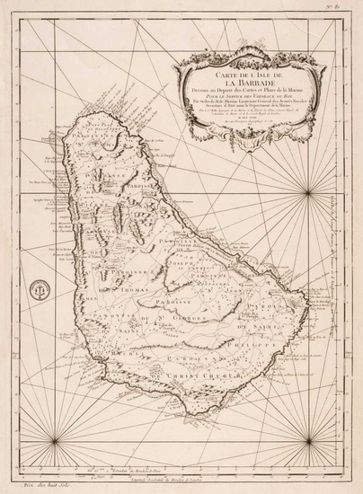
Barbados. Bellin (Jacques Nicolas), Carte de L'Isle de La Barbade, 1758
Barbados. Bellin (Jacques Nicolas), Carte de L'Isle de la Barbade Dressee au Depost des Cartes et Plans de la Marine..., Paris 1758, uncoloured engraved chart, ornate cartouche, numerous rhumb lines, stamp of the 'Depot de la Marine', one repaired closed tear, 590 x 420 mm, together with Homann (J. B.). Insula Barbadoes in suas Parochias distincta..., Nuremberg, circa 1737, engraved map with contemporary wash colouring, trimmed to the neatline and laid on near-contemporary paper, with Rossi (V.). Carta esatta rappresentante l'Isola di Barbados, published M. Coltellini, circa 1763, uncoloured engraved map, slight spotting, 230 x 190 mm, mounted, plus Moll (Herman). A New Map of the Island of Barbados..., circa 1708, uncoloured engraved map, old folds, toned overall, 180 x 260 mm, and Edwards (Bryan). Map of the Island of Barbadoes for the History of the West Indies..., John Stockdale, Oct. 6th 1791, uncoloured engraved map, very slight spotting, 240 x 190 mm, with Bellin (N.). Carte de L'Isle de La Barbade, circa 1780, engraved map with contemporary wash colouring, 215 x 165 mm, mounted, plus Lucas (Fielding, publisher). Barbadoes, published Baltimore, circa 1823, engraved map with contemporary wash colouring, slight spotting and toning, 310 x 250 mm, mounted, framed and glazed (Quantity: 7)
[ translate ]View it on
Sale price
Estimate
Time, Location
Auction House
Barbados. Bellin (Jacques Nicolas), Carte de L'Isle de la Barbade Dressee au Depost des Cartes et Plans de la Marine..., Paris 1758, uncoloured engraved chart, ornate cartouche, numerous rhumb lines, stamp of the 'Depot de la Marine', one repaired closed tear, 590 x 420 mm, together with Homann (J. B.). Insula Barbadoes in suas Parochias distincta..., Nuremberg, circa 1737, engraved map with contemporary wash colouring, trimmed to the neatline and laid on near-contemporary paper, with Rossi (V.). Carta esatta rappresentante l'Isola di Barbados, published M. Coltellini, circa 1763, uncoloured engraved map, slight spotting, 230 x 190 mm, mounted, plus Moll (Herman). A New Map of the Island of Barbados..., circa 1708, uncoloured engraved map, old folds, toned overall, 180 x 260 mm, and Edwards (Bryan). Map of the Island of Barbadoes for the History of the West Indies..., John Stockdale, Oct. 6th 1791, uncoloured engraved map, very slight spotting, 240 x 190 mm, with Bellin (N.). Carte de L'Isle de La Barbade, circa 1780, engraved map with contemporary wash colouring, 215 x 165 mm, mounted, plus Lucas (Fielding, publisher). Barbadoes, published Baltimore, circa 1823, engraved map with contemporary wash colouring, slight spotting and toning, 310 x 250 mm, mounted, framed and glazed (Quantity: 7)
[ translate ]


