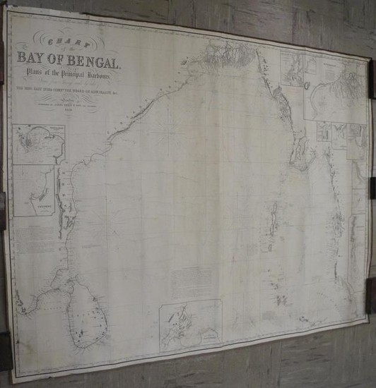
Chart of the Bay of Bengal
Title/Content of Map: Chart of the Bay of Bengal,
Date: 1858
Cartographer: IMRAY, JAMES
Publisher: JAMES IMRAY & SON
Size: 39.25Height - 50.25Width
including plans of the principal harbours, drawn from surveys made by order of The Hon: East India Compy. the Board of Admiralty, &c. Blue back sea chart with soundings. Eleven insets including the mouths of the rivers Hoogly and Aracan by Capt. R. Lloyd, Indian Navy. Handsome period title graphics. Scarce chart of the dangerous Burmese waters at the mouth of the Irrawaddy. Edges bound with sailmaker's tape. Right margin very dust soiled. Numerous pencil notes, used at sea. Some loose edging.
Reserve: $400.00
Shipping:
Domestic: Flat-rate of $24.00 to anywhere within the contiguous U.S.
International: Foreign shipping rates are determined by destination.
Combined shipping: Please ask about combined shipping for multiple lots before bidding.
Location: This item ships from Tennessee
Your purchase is protected:
Photos, descriptions, and estimates were prepared with the utmost care by a fully certified expert and appraiser. All items in this sale are guaranteed authentic.
In the rare event that the item did not conform to the lot description in the sale, Jasper52 specialists are here to help. Buyers may return the item for a full refund provided you notify Jasper52 within 5 days of receiving the item.
Condition Report: Good
View it on
Estimate
Time, Location
Auction House
Title/Content of Map: Chart of the Bay of Bengal,
Date: 1858
Cartographer: IMRAY, JAMES
Publisher: JAMES IMRAY & SON
Size: 39.25Height - 50.25Width
including plans of the principal harbours, drawn from surveys made by order of The Hon: East India Compy. the Board of Admiralty, &c. Blue back sea chart with soundings. Eleven insets including the mouths of the rivers Hoogly and Aracan by Capt. R. Lloyd, Indian Navy. Handsome period title graphics. Scarce chart of the dangerous Burmese waters at the mouth of the Irrawaddy. Edges bound with sailmaker's tape. Right margin very dust soiled. Numerous pencil notes, used at sea. Some loose edging.
Reserve: $400.00
Shipping:
Domestic: Flat-rate of $24.00 to anywhere within the contiguous U.S.
International: Foreign shipping rates are determined by destination.
Combined shipping: Please ask about combined shipping for multiple lots before bidding.
Location: This item ships from Tennessee
Your purchase is protected:
Photos, descriptions, and estimates were prepared with the utmost care by a fully certified expert and appraiser. All items in this sale are guaranteed authentic.
In the rare event that the item did not conform to the lot description in the sale, Jasper52 specialists are here to help. Buyers may return the item for a full refund provided you notify Jasper52 within 5 days of receiving the item.
Condition Report: Good


