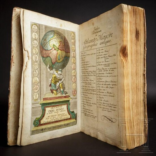
"Descriptio Orbis Antiqui in XLIV. Tabulis" by David
"Descriptio Orbis Antiqui in XLIV. Tabulis" by David Koehler; hand-coloured atlas, Nuremberg, circa 1720Folio, engraved title and index, 40 (of 44) hand-coloured engraved maps of the ancient world. The atlas shows the western world, with maps from Eurasia/Africa, Europe, Hispania, Gallia, the British Isles, Germania, Italia, Palestine, Egypt, Mesopotamia, etc. Many maps decorated with numismatic elements.Coloured title, on the reverse a handwritten property note ("Ludwig Grimme, cand. phil., November 1879"), index. 40 double-page maps (# 9, 15, 23, 24 missing), original coloring. Title, Index, the first two maps and maps 27 to 37 with damages to the white margin, a brown spot in the top corners of maps 19 to 27. The damages limited to the white margins. Map 14 (Italy) bent down the middle. A 4 cm long tear doubled-up with a paper strip on map 39 (Mauretania et Numidia), no loss to paper, not touching the map. Occasional, very light browning and foxing to the maps. The fly-leaves soiled.Contemporary half-vellum over marbled boards with gilt stamped back (repaired, with a 30mm crack front bottom), worn at the corners and around the edges. Overall a still acceptable copy of this skilfully elaborated atlas.Cf. Phillips, Atlases, 30. Condition: III
[ translate ]View it on
Sale price
Estimate
Time, Location
Auction House
"Descriptio Orbis Antiqui in XLIV. Tabulis" by David Koehler; hand-coloured atlas, Nuremberg, circa 1720Folio, engraved title and index, 40 (of 44) hand-coloured engraved maps of the ancient world. The atlas shows the western world, with maps from Eurasia/Africa, Europe, Hispania, Gallia, the British Isles, Germania, Italia, Palestine, Egypt, Mesopotamia, etc. Many maps decorated with numismatic elements.Coloured title, on the reverse a handwritten property note ("Ludwig Grimme, cand. phil., November 1879"), index. 40 double-page maps (# 9, 15, 23, 24 missing), original coloring. Title, Index, the first two maps and maps 27 to 37 with damages to the white margin, a brown spot in the top corners of maps 19 to 27. The damages limited to the white margins. Map 14 (Italy) bent down the middle. A 4 cm long tear doubled-up with a paper strip on map 39 (Mauretania et Numidia), no loss to paper, not touching the map. Occasional, very light browning and foxing to the maps. The fly-leaves soiled.Contemporary half-vellum over marbled boards with gilt stamped back (repaired, with a 30mm crack front bottom), worn at the corners and around the edges. Overall a still acceptable copy of this skilfully elaborated atlas.Cf. Phillips, Atlases, 30. Condition: III
[ translate ]


