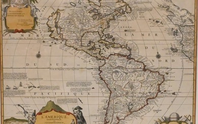
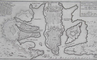
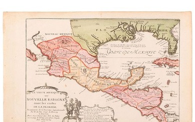
[FER] | Mappe-monde ou carte generale de la terre, 1760, large hand-coloured wall-map
[FER, NICOLAS DE]
MAPPE-MONDE OU CARTE GENERALE DE LA TERRE. PARIS: LOUIS-CHARLES DESNOS, 1760
Large engraved wall-map, (785 x 1095mm., engraved area; 970 x 1265mm., total area), hand-coloured, backed on linen, old folds and occasional repairs or restoration
HIGHLY DECORATIVE DOUBLE-HEMISPHERE MAP OF THE WORLD, first published by Nicolas de Fer in 1694, surrounded by allegorical decorations and scientific diagrams of the heavens; the plates passed to de Fer's successors, first Guillaume Danet and then Desnos. Both made extensive changes to the plates, successively updating and improving the geographical delineation.
LITERATURE:
cf. Shirley 560
To view Shipping Calculator, please click here
Condition Report:
Condition is described in the main body of the cataloguing, where appropriate
Please note: Condition 11 of the Conditions of Business for Buyers (Online Only) is not applicable to this lot.
"In response to your inquiry, we are pleased to provide you with a general report of the condition of the property described above. Since we are not professional conservators or restorers, we urge you to consult with a restorer or conservator of your choice who will be better able to provide a detailed, professional report. Prospective buyers should inspect each lot to satisfy themselves as to condition and must understand that any statement made by Sotheby's is merely a subjective, qualified opinion. Prospective buyers should also refer to any Important Notices regarding this sale, which are printed in the Sale Catalogue.
NOTWITHSTANDING THIS REPORT OR ANY DISCUSSIONS CONCERNING A LOT, ALL LOTS ARE OFFERED AND SOLD AS IS" IN ACCORDANCE WITH THE CONDITIONS OF BUSINESS PRINTED IN THE SALE CATALOGUE."
View it on
Sale price
Estimate
Time, Location
Auction House
[FER, NICOLAS DE]
MAPPE-MONDE OU CARTE GENERALE DE LA TERRE. PARIS: LOUIS-CHARLES DESNOS, 1760
Large engraved wall-map, (785 x 1095mm., engraved area; 970 x 1265mm., total area), hand-coloured, backed on linen, old folds and occasional repairs or restoration
HIGHLY DECORATIVE DOUBLE-HEMISPHERE MAP OF THE WORLD, first published by Nicolas de Fer in 1694, surrounded by allegorical decorations and scientific diagrams of the heavens; the plates passed to de Fer's successors, first Guillaume Danet and then Desnos. Both made extensive changes to the plates, successively updating and improving the geographical delineation.
LITERATURE:
cf. Shirley 560
To view Shipping Calculator, please click here
Condition Report:
Condition is described in the main body of the cataloguing, where appropriate
Please note: Condition 11 of the Conditions of Business for Buyers (Online Only) is not applicable to this lot.
"In response to your inquiry, we are pleased to provide you with a general report of the condition of the property described above. Since we are not professional conservators or restorers, we urge you to consult with a restorer or conservator of your choice who will be better able to provide a detailed, professional report. Prospective buyers should inspect each lot to satisfy themselves as to condition and must understand that any statement made by Sotheby's is merely a subjective, qualified opinion. Prospective buyers should also refer to any Important Notices regarding this sale, which are printed in the Sale Catalogue.
NOTWITHSTANDING THIS REPORT OR ANY DISCUSSIONS CONCERNING A LOT, ALL LOTS ARE OFFERED AND SOLD AS IS" IN ACCORDANCE WITH THE CONDITIONS OF BUSINESS PRINTED IN THE SALE CATALOGUE."
![[FER] | Mappe-monde ou carte generale de la terre, 1760, large hand-coloured wall-map [FER] | Mappe-monde ou carte generale de la terre, 1760, large hand-coloured wall-map](https://gcp-la8-storage-cdn.lot-art.com/public/upl/33/FER-Mappe-monde-ou-carte-generale-de-la-terre-1760-large-hand-coloured-wall-map_1595025911_6183.jpg)


![[Cartographie] [Artois - Picardie - Flandre... - Lot 261 - Richard Maison de ventes [Cartographie] [Artois - Picardie - Flandre... - Lot 261 - Richard Maison de ventes](https://gcp-la8-storage-cdn.lot-art.com/public/upl/61/Cartographie-Artois-Picardie-Flandre-Lot-261-Richard-Maison-de-ventes_6626e907edd6e-thumb-01832600_1713826057-6626e909047ab.jpg)


