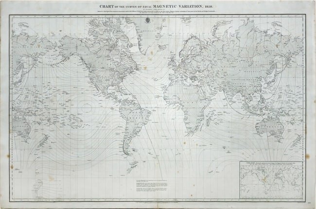
Frederick Evans World Map showing Magnetic Declinations across Earth
EVANS, Frederick J. (19th Century).
[Worldmap] Chart of the Curves of Equal Magnetic Variation, 1858.
Engraved map by J. & C. Walker.
London: British Admiralty/ J.D. Potter, 1859.
27" x 40 1/8" sheet.
Worldmap showing the magnetic declination across the earth's surface, that is the variation of magnetic north from geographic north, which itself varies slightly with time. The "Index Chart" approximately shows this annual change of the magnetic variation for the year 1858. The first isogonic chart to be published by the British Admiralty.
View it on
Sale price
Estimate
Reserve
Time, Location
Auction House
EVANS, Frederick J. (19th Century).
[Worldmap] Chart of the Curves of Equal Magnetic Variation, 1858.
Engraved map by J. & C. Walker.
London: British Admiralty/ J.D. Potter, 1859.
27" x 40 1/8" sheet.
Worldmap showing the magnetic declination across the earth's surface, that is the variation of magnetic north from geographic north, which itself varies slightly with time. The "Index Chart" approximately shows this annual change of the magnetic variation for the year 1858. The first isogonic chart to be published by the British Admiralty.


