Gaius Julius Solinus / Sebastian Munster / Pomponius Mela - POLYHISTOR, Rerum toto Orbe Memorabilium Thesaurus Locupletissimus - 1538
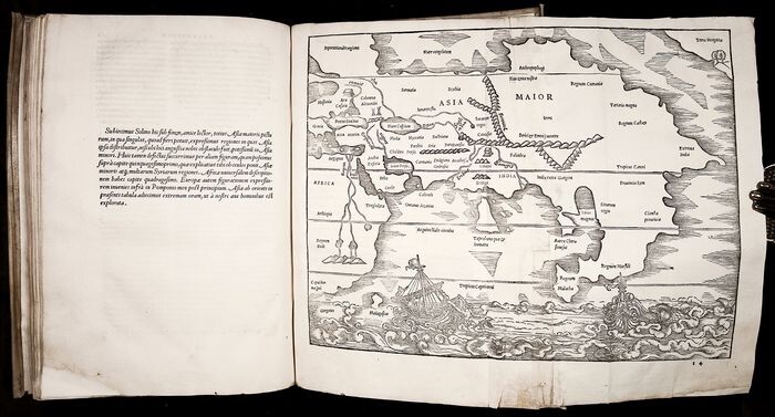
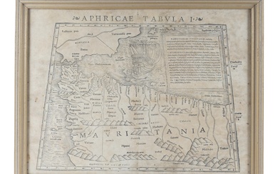
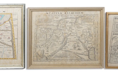
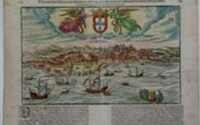
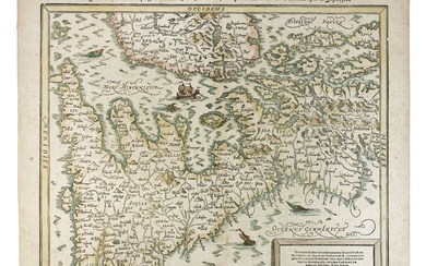
WITH THE EARLIEST PRINTED REPRESENTATION OF THE NORTH-WEST COAST OF AMERICA THE FAMOUS 1538 EDITION OF THE 'POLYHISTOR' - THE FIRST ILLUSTRATED EDITION, THE FIRST EDITED BY SEBASTIAN MUNSTER, AND THE FIRST APPEARANCE IN PRINT OF MUNSTER'S REMARKABLE MAPS. ILLUSTRATED BY 20 BEAUTIFUL WOODCUT MAPS, INCLUDING 2 FOLDING. The text is by Gaius Julius Solinus and Pomponius Mela. The full title reads as follows: "C. Iulii Solini Polyhistor, Rerum Toto Orbe Memorabilium thesaurus locupletissimus. / Huic ob Argumenti Similitudinem / Pomponii Melae De Situ Orbis Libros Tres, Fide Diligentiaque summa recognitos, adiunximus. / Accesserunt his praeter nova scholia, quae loca autoris utriusq; obscuriora copiose pa. Bim [i. e. passim] illustrant, etiam marium, sinuumq; diversorum situs pulchre deliniantes. / Cum Indice rerum atque verborum in utroq; observandorum locupleti. Bimo [i. e. locupletissimo] . / Basileae / 1538. " The colophon reads as follows: "Basileae apud Michaelem Isingrinium et Henricum Petri. / M. D. XXXVIII. " The 'Polyhistor' is edited by Sebastian Münster with his copious notes updating the accounts of Solinus and Mela with more recent geographical information. The text is in Latin throughout, though with some passages in Hebrew and Greek. Preliminaries include a Life of Solinus by Johannes Camers, and an extensive index. Illustrated by 20 woodcut maps (probably by Sebastian Münster) , including 2 fold-out double-page woodcut maps hors-texte, and 18 woodcut maps or topographical views in-text. 2 of the latter are full-page. The volume is further illustrated by numerous fine woodcut initials of various sizes, both decorative and historiated, including a fine large 10-line initial ‘C’ at the opening of Solinus showing Adam and Eve’s expulsion from Paradise. The volume is printed in folio at Basel by Michael Isingrin and Heinrich Petri in 1538. It is bound in full 17th-century semi-rigid vellum with yapp edges, a blind-stamped ornamental arabesque centerpiece on both covers, and a flat spine. The volume is COMPLETE IN ALL RESPECTS INCLUDING THE REAR BLANK. It paginates (20) , 230, (2) pp. THIS EXAMPLE IS IN EXCELLENT CONDITION. It is a nice, wide-margined example of this important and scarce illustrated edition, with all maps intact and in good, strong impressions. The binding shows some rubbing with a few minor scratches and some soiling; the vellum is of course slightly bowed (as usual) . The title page shows an early ownership signature (undeciphered) , and 2 marginal repairs (without any loss of text) . The leaves beginning from quire f show minor, harmless marginal repair to the tip of the bottom outer corner (far from text; no loss) . There is some light water-staining (mostly marginal) towards the end of the volume. Both folding maps show some wear along the fold and some light water-staining; the Asia map is partially reinforced on the blank verso along the fold (without loss) , and shows a short closed tear at the bottom margin. There are a few minor manuscript marginal notes, and a rather pleasing pen-and-ink drawing of a peacock to bottom margin of p. 55 in a 16th-century hand. The celebrated Asia Maior folding map (bound after p. 149) contains “The earliest representation of the north-west coast of America on a printed map. ” (Burden) . It is shown in the upper right corner of this map as a land mass labeled “Terra Incognita,” and depicted with a small bay, trees, and hills. The map is also noteworthy for showing the first delineations of a strait between Asia and America, some two hundred years before Bering’s voyage. (Burden) At the time of publication, scholars and voyagers were still debating the plausibility of a land mass connection between the Asian and American continents. It has also been noted that “this is one of the earliest obtainable maps devoted solely to the continent of Asia. ” This edition of Polyhistor also includes a detailed folding map (bound after p. 38 and labeled “Typus Graeciae”) of the Greek Isles, showing parts of modern day Turkey, Cyprus and Eastern Europe including the Black Sea. The 2 full-page maps depict: the continent of Europe (p. [158]) , including Asia Minor and parts of Russia; and the northern half of the continent of Africa (p. [83]) based upon Ptolemy and some modern sources, and prominently showing the “Mountains of the Moon” (Montes Lunae) , a mountain range in central Africa that is the source of the White Nile, including the Holy Land and Arabia. Among the smaller maps within the text are: a map of Russia (p. 48) , especially “noteworthy on account of the river-system of Russia being here for the first time represented with tolerable accuracy - even more correct than on the maps of Antonius Wied and Herberstein. [. . .] it appears to be founded on communications from Herberstein and from the learned canon in Cracow, Mathias a Michou. ” (Nordenskiöld) The book also contains maps of: England, India, Italy, Morea, Rhodos, Rhetia and Helvetia, Black Forest, etc. The editor, Sebastian Münster, provided his own commentary to the text of Solinus and Mela, and probably also served as its cartographer (although there is still some doubt about this) . Münster was a German cartographer, cosmographer, and a Christian Hebraist scholar. His work, the Cosmographia from 1544, was the earliest German description of the world. In 1540 he published his own “updated” edition of Ptolemy’s Geography, which included maps of the new or modern world. Münster was also one of the first cartographers to create space in the woodblock for the insertion of metal-cut place-names. His decision to refer to the New World as “America” in his 1544 edition of the Cosmographia greatly contributed to the name’s endurance. “In 1538 Münster produced an edition of Solinus and Mela which called upon his skills as an artist, linguist and his connections with the Basel printers. His editions served the humanist’s urge to bring classical writers to honour by supplying a new accurate version of their texts and set them against the knowledge gained by the modern age. This latter was achieved by a commentary on the text, and by twenty woodcut maps. Characteristically, he augmented the section of his commentary on southwest Germany, achieving a closer parity in detail with those parts of the Mediterranean in which Solinus had a greater interest. ” (Matthew Mc. Lean, The Cosmographia of Sebastian Münster: Describing the World in the Reformation, p. 168) Münster’s commentary was an expansion and development of earlier notes by Pedro Juan Oliver, a Spanish converso Jew from Valencia, a noted humanist who studied in Paris and personally knew Erasmus. Pomponius Mela, was a 1st-century AD Roman geographer at the courts of Caligula and Claudius. His De situ orbis, the only ancient treatise on geography in classical Latin Written about 43 or 44 CE. It remained influential until the beginning of the age of exploration, 13 centuries later. In this concise treatise, Mela elaborated his description of the world with details - often fantastic - of the habits and customs of nations. Mela’s work contains the earliest mentions of the Baltic Sea (Sinus Codanus) . His knowledge of the positions of Britain, Ireland, and the coasts of Gaul and north Germany were superior to Strabo, and he was the first to mention the Orkney Islands (Orcades) off the Scottish coast. Gaius Julius Solinus, Latin grammarian and compiler, flourished around the middle of the 3rd century AD. He was the author of De mirabilibus mundi, which was revised in the 6th century under the present title Polyhistor, and was quite popular during the middle ages. After Ptolemy, Solinus was the classical authority whose writings most strongly informed Renaissance geographical thought. The Polyhistor is an encyclopedic description of curiosities and marvels of the world in a chorographical framework. It contains a short account of the ancient world with remarks on historical, social, religious and natural history questions. The greater part of it is taken from Pliny’s Natural History and the Geography of Pomponius Mela. Solinus’ work had wide appeal. Saint Augustine himself drew on Solinus, as did all the other leading Christian thinkers of the Middle Ages. The stories and fabulous images enlivened Christian maps right down to the Age of Discovery. They became an all-encompassing network of fantasy, replacing the forgotten rational grid work of latitude and longitude, which had been Ptolemy’s legacy. Solinus found wonders near and far. From Italy he reported people who sacrificed to Apollo by dancing barefoot on burning coals, pythons that grew long and fat by feeding on the udders of milk cows, and lynxes whose urine congealed to the hardness of precious stone, having magnetic powers and the color of amber. Grasshoppers and crickets in Rhegium still dared make no sound because Hercules, irritated by their noise, had once ordered them to keep silent. Further afield were the dog-headed Simeans of Ethiopia, ruled by a dog-king. Along the Ethiopian coast were peoples with four eyes, while along the Niger were ants as big as mastiffs. In Germany there was a mule-like creature with such a long upper lip that he cannot feed except walking backward. Human monstrosities that were normal in remote parts of the world included tribes who had their eight-toed feet turned backwards, men with dogs’ heads and talons for fingers who barked for speech, people who had only one leg, but with a foot so large that it protected them from the hot sun by serving as a parasol. (Daniel J. Boorstin, The Discoverers, p. 110) BM STC German p. 818; Burden, The Mapping of North America, 11; Schweiger II. 2, 960; Graesse VI, p. 431; Shirley, Maps in the atlases of The British Library, p. 1700 (G. Sol-1a) ; Hieronymus, Oberr. Buchillustr. II, 470; Wagner, Cartography of the NW Coast I, 9; Nordenskiöld Collection II, 285; Norwich, Maps of Africa, p. 372; Zacharakis, Maps of Greece, 2188.
[ translate ]View it on
Estimate
Time, Location
Auction House
WITH THE EARLIEST PRINTED REPRESENTATION OF THE NORTH-WEST COAST OF AMERICA THE FAMOUS 1538 EDITION OF THE 'POLYHISTOR' - THE FIRST ILLUSTRATED EDITION, THE FIRST EDITED BY SEBASTIAN MUNSTER, AND THE FIRST APPEARANCE IN PRINT OF MUNSTER'S REMARKABLE MAPS. ILLUSTRATED BY 20 BEAUTIFUL WOODCUT MAPS, INCLUDING 2 FOLDING. The text is by Gaius Julius Solinus and Pomponius Mela. The full title reads as follows: "C. Iulii Solini Polyhistor, Rerum Toto Orbe Memorabilium thesaurus locupletissimus. / Huic ob Argumenti Similitudinem / Pomponii Melae De Situ Orbis Libros Tres, Fide Diligentiaque summa recognitos, adiunximus. / Accesserunt his praeter nova scholia, quae loca autoris utriusq; obscuriora copiose pa. Bim [i. e. passim] illustrant, etiam marium, sinuumq; diversorum situs pulchre deliniantes. / Cum Indice rerum atque verborum in utroq; observandorum locupleti. Bimo [i. e. locupletissimo] . / Basileae / 1538. " The colophon reads as follows: "Basileae apud Michaelem Isingrinium et Henricum Petri. / M. D. XXXVIII. " The 'Polyhistor' is edited by Sebastian Münster with his copious notes updating the accounts of Solinus and Mela with more recent geographical information. The text is in Latin throughout, though with some passages in Hebrew and Greek. Preliminaries include a Life of Solinus by Johannes Camers, and an extensive index. Illustrated by 20 woodcut maps (probably by Sebastian Münster) , including 2 fold-out double-page woodcut maps hors-texte, and 18 woodcut maps or topographical views in-text. 2 of the latter are full-page. The volume is further illustrated by numerous fine woodcut initials of various sizes, both decorative and historiated, including a fine large 10-line initial ‘C’ at the opening of Solinus showing Adam and Eve’s expulsion from Paradise. The volume is printed in folio at Basel by Michael Isingrin and Heinrich Petri in 1538. It is bound in full 17th-century semi-rigid vellum with yapp edges, a blind-stamped ornamental arabesque centerpiece on both covers, and a flat spine. The volume is COMPLETE IN ALL RESPECTS INCLUDING THE REAR BLANK. It paginates (20) , 230, (2) pp. THIS EXAMPLE IS IN EXCELLENT CONDITION. It is a nice, wide-margined example of this important and scarce illustrated edition, with all maps intact and in good, strong impressions. The binding shows some rubbing with a few minor scratches and some soiling; the vellum is of course slightly bowed (as usual) . The title page shows an early ownership signature (undeciphered) , and 2 marginal repairs (without any loss of text) . The leaves beginning from quire f show minor, harmless marginal repair to the tip of the bottom outer corner (far from text; no loss) . There is some light water-staining (mostly marginal) towards the end of the volume. Both folding maps show some wear along the fold and some light water-staining; the Asia map is partially reinforced on the blank verso along the fold (without loss) , and shows a short closed tear at the bottom margin. There are a few minor manuscript marginal notes, and a rather pleasing pen-and-ink drawing of a peacock to bottom margin of p. 55 in a 16th-century hand. The celebrated Asia Maior folding map (bound after p. 149) contains “The earliest representation of the north-west coast of America on a printed map. ” (Burden) . It is shown in the upper right corner of this map as a land mass labeled “Terra Incognita,” and depicted with a small bay, trees, and hills. The map is also noteworthy for showing the first delineations of a strait between Asia and America, some two hundred years before Bering’s voyage. (Burden) At the time of publication, scholars and voyagers were still debating the plausibility of a land mass connection between the Asian and American continents. It has also been noted that “this is one of the earliest obtainable maps devoted solely to the continent of Asia. ” This edition of Polyhistor also includes a detailed folding map (bound after p. 38 and labeled “Typus Graeciae”) of the Greek Isles, showing parts of modern day Turkey, Cyprus and Eastern Europe including the Black Sea. The 2 full-page maps depict: the continent of Europe (p. [158]) , including Asia Minor and parts of Russia; and the northern half of the continent of Africa (p. [83]) based upon Ptolemy and some modern sources, and prominently showing the “Mountains of the Moon” (Montes Lunae) , a mountain range in central Africa that is the source of the White Nile, including the Holy Land and Arabia. Among the smaller maps within the text are: a map of Russia (p. 48) , especially “noteworthy on account of the river-system of Russia being here for the first time represented with tolerable accuracy - even more correct than on the maps of Antonius Wied and Herberstein. [. . .] it appears to be founded on communications from Herberstein and from the learned canon in Cracow, Mathias a Michou. ” (Nordenskiöld) The book also contains maps of: England, India, Italy, Morea, Rhodos, Rhetia and Helvetia, Black Forest, etc. The editor, Sebastian Münster, provided his own commentary to the text of Solinus and Mela, and probably also served as its cartographer (although there is still some doubt about this) . Münster was a German cartographer, cosmographer, and a Christian Hebraist scholar. His work, the Cosmographia from 1544, was the earliest German description of the world. In 1540 he published his own “updated” edition of Ptolemy’s Geography, which included maps of the new or modern world. Münster was also one of the first cartographers to create space in the woodblock for the insertion of metal-cut place-names. His decision to refer to the New World as “America” in his 1544 edition of the Cosmographia greatly contributed to the name’s endurance. “In 1538 Münster produced an edition of Solinus and Mela which called upon his skills as an artist, linguist and his connections with the Basel printers. His editions served the humanist’s urge to bring classical writers to honour by supplying a new accurate version of their texts and set them against the knowledge gained by the modern age. This latter was achieved by a commentary on the text, and by twenty woodcut maps. Characteristically, he augmented the section of his commentary on southwest Germany, achieving a closer parity in detail with those parts of the Mediterranean in which Solinus had a greater interest. ” (Matthew Mc. Lean, The Cosmographia of Sebastian Münster: Describing the World in the Reformation, p. 168) Münster’s commentary was an expansion and development of earlier notes by Pedro Juan Oliver, a Spanish converso Jew from Valencia, a noted humanist who studied in Paris and personally knew Erasmus. Pomponius Mela, was a 1st-century AD Roman geographer at the courts of Caligula and Claudius. His De situ orbis, the only ancient treatise on geography in classical Latin Written about 43 or 44 CE. It remained influential until the beginning of the age of exploration, 13 centuries later. In this concise treatise, Mela elaborated his description of the world with details - often fantastic - of the habits and customs of nations. Mela’s work contains the earliest mentions of the Baltic Sea (Sinus Codanus) . His knowledge of the positions of Britain, Ireland, and the coasts of Gaul and north Germany were superior to Strabo, and he was the first to mention the Orkney Islands (Orcades) off the Scottish coast. Gaius Julius Solinus, Latin grammarian and compiler, flourished around the middle of the 3rd century AD. He was the author of De mirabilibus mundi, which was revised in the 6th century under the present title Polyhistor, and was quite popular during the middle ages. After Ptolemy, Solinus was the classical authority whose writings most strongly informed Renaissance geographical thought. The Polyhistor is an encyclopedic description of curiosities and marvels of the world in a chorographical framework. It contains a short account of the ancient world with remarks on historical, social, religious and natural history questions. The greater part of it is taken from Pliny’s Natural History and the Geography of Pomponius Mela. Solinus’ work had wide appeal. Saint Augustine himself drew on Solinus, as did all the other leading Christian thinkers of the Middle Ages. The stories and fabulous images enlivened Christian maps right down to the Age of Discovery. They became an all-encompassing network of fantasy, replacing the forgotten rational grid work of latitude and longitude, which had been Ptolemy’s legacy. Solinus found wonders near and far. From Italy he reported people who sacrificed to Apollo by dancing barefoot on burning coals, pythons that grew long and fat by feeding on the udders of milk cows, and lynxes whose urine congealed to the hardness of precious stone, having magnetic powers and the color of amber. Grasshoppers and crickets in Rhegium still dared make no sound because Hercules, irritated by their noise, had once ordered them to keep silent. Further afield were the dog-headed Simeans of Ethiopia, ruled by a dog-king. Along the Ethiopian coast were peoples with four eyes, while along the Niger were ants as big as mastiffs. In Germany there was a mule-like creature with such a long upper lip that he cannot feed except walking backward. Human monstrosities that were normal in remote parts of the world included tribes who had their eight-toed feet turned backwards, men with dogs’ heads and talons for fingers who barked for speech, people who had only one leg, but with a foot so large that it protected them from the hot sun by serving as a parasol. (Daniel J. Boorstin, The Discoverers, p. 110) BM STC German p. 818; Burden, The Mapping of North America, 11; Schweiger II. 2, 960; Graesse VI, p. 431; Shirley, Maps in the atlases of The British Library, p. 1700 (G. Sol-1a) ; Hieronymus, Oberr. Buchillustr. II, 470; Wagner, Cartography of the NW Coast I, 9; Nordenskiöld Collection II, 285; Norwich, Maps of Africa, p. 372; Zacharakis, Maps of Greece, 2188.
[ translate ]