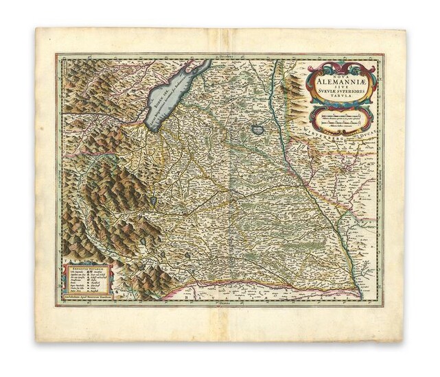
Hondius, H. Alemanniae sive Sveviae Superioris Tabula
Hondius, Henricus
Nova Alemanniae sive Sveviae Superioris Tabula
1636
Copperplate engraving; coloured
Printed area: 48 x 38.2 cm; 18.8 x 15 in
Map from the English version of the Mercator-Hondius Atlas, published by the brothers-in-law Henricus Hondius and Johannes Janssonius in 1636. The map shows the upper Swabia. The first version of this map was published in the German edition in 1633. The map shows the region between the Alps, the lake of Constance, and the border region between Bavaria and Baden Wurttemberg. The north, however, is not drawn on top of the map, but rather on the right. Directing a map towards the West was quite common for cartographers of the 17th century, as was the use of decorative text cartouches, showing the title, miles, legend, and information on the publisher. text on verso describes particularities of the area in question and additional information for the reader.
From the Legendary Vladi Collection of Historical Maps which includes 280 examples of the finest quality antique maps brought to auction with proceeds benefiting MapAction, an organization that uses maps and technology to aid those in disaster-stricken areas. Each map is accompanied by a certificate of authenticity issued by the consignor.
Condition: Center fold, light paper abrasion on lower right margin, light staining, very good condition, text on verso.
This item will be shipped from Hamburg, Germany. Shipping details are to be coordinated with our recommended shipper
View it on
Estimate
Time, Location
Auction House
Hondius, Henricus
Nova Alemanniae sive Sveviae Superioris Tabula
1636
Copperplate engraving; coloured
Printed area: 48 x 38.2 cm; 18.8 x 15 in
Map from the English version of the Mercator-Hondius Atlas, published by the brothers-in-law Henricus Hondius and Johannes Janssonius in 1636. The map shows the upper Swabia. The first version of this map was published in the German edition in 1633. The map shows the region between the Alps, the lake of Constance, and the border region between Bavaria and Baden Wurttemberg. The north, however, is not drawn on top of the map, but rather on the right. Directing a map towards the West was quite common for cartographers of the 17th century, as was the use of decorative text cartouches, showing the title, miles, legend, and information on the publisher. text on verso describes particularities of the area in question and additional information for the reader.
From the Legendary Vladi Collection of Historical Maps which includes 280 examples of the finest quality antique maps brought to auction with proceeds benefiting MapAction, an organization that uses maps and technology to aid those in disaster-stricken areas. Each map is accompanied by a certificate of authenticity issued by the consignor.
Condition: Center fold, light paper abrasion on lower right margin, light staining, very good condition, text on verso.
This item will be shipped from Hamburg, Germany. Shipping details are to be coordinated with our recommended shipper


