MAP, Maryland, Potomac River, Bruce
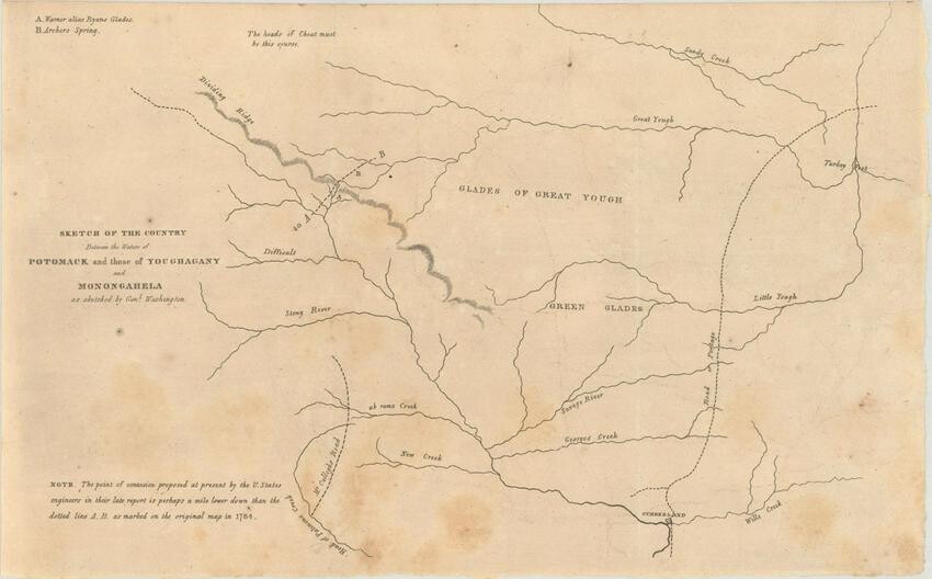
Rare Early Map of the Upper Potomac River. Maryland, Potomac River. Norman Bruce, Sketch of the Country Between the Waters of Potomack and Those of Youghagany and Monongahela as Sketched by Genl. Washington, from , 1826 (circa). Black & White. While the title indicates that this map was sketched by George Washington, it was in fact drawn by Norman Bruce (with likely input from Washington). It depicts the region to the northwest of Cumberland, Maryland and identifies a number of creeks, rivers, glades, early roads, as well as a possible connection point between the Potomac River and the Great Yough Creek. A note indicates that the Bruce/Washington line is about a mile upriver of the "connexion proposed at present by the U. States engineer." Published in the Report of the House Committee on Roads and Canals Concerning Said Canal.
George Washington was a lifelong advocate for making the Potomac River navigable as a route to the west. When he retired to civilian life in 1784, he was founder and first president of the Potowmack Canal Company which obtained support from the Maryland and Virginia legislatures to build a series of five “skirting canals” to circumvent the parts of the Potomac too difficult for navigation. Washington remained the president and guiding force of the company until he became the country’s first president in 1789. The work on the canal was difficult and not completed until 1802, three years after Washington’s death. Norman Bruce was the Revolutionary War head of Maryland’s militia and a prosperous Maryland land owner. In 1783 the Maryland legislature appointed Bruce to examine the upper Potomac and submit a plan for making it navigable. No action was taken by Maryland until Washington’s involvement.
The map is rare with no past sales records and only one institutional example located on OCLC.
LITERATURE: Claussen & Friis #6.
Dimensions: 12.3 x 7.8 in
Condition Report: Issued folding with scattered foxing. Grade: B
View it on
Estimate
Time, Location
Auction House
Rare Early Map of the Upper Potomac River. Maryland, Potomac River. Norman Bruce, Sketch of the Country Between the Waters of Potomack and Those of Youghagany and Monongahela as Sketched by Genl. Washington, from , 1826 (circa). Black & White. While the title indicates that this map was sketched by George Washington, it was in fact drawn by Norman Bruce (with likely input from Washington). It depicts the region to the northwest of Cumberland, Maryland and identifies a number of creeks, rivers, glades, early roads, as well as a possible connection point between the Potomac River and the Great Yough Creek. A note indicates that the Bruce/Washington line is about a mile upriver of the "connexion proposed at present by the U. States engineer." Published in the Report of the House Committee on Roads and Canals Concerning Said Canal.
George Washington was a lifelong advocate for making the Potomac River navigable as a route to the west. When he retired to civilian life in 1784, he was founder and first president of the Potowmack Canal Company which obtained support from the Maryland and Virginia legislatures to build a series of five “skirting canals” to circumvent the parts of the Potomac too difficult for navigation. Washington remained the president and guiding force of the company until he became the country’s first president in 1789. The work on the canal was difficult and not completed until 1802, three years after Washington’s death. Norman Bruce was the Revolutionary War head of Maryland’s militia and a prosperous Maryland land owner. In 1783 the Maryland legislature appointed Bruce to examine the upper Potomac and submit a plan for making it navigable. No action was taken by Maryland until Washington’s involvement.
The map is rare with no past sales records and only one institutional example located on OCLC.
LITERATURE: Claussen & Friis #6.
Dimensions: 12.3 x 7.8 in
Condition Report: Issued folding with scattered foxing. Grade: B


