MAP, North Carolina, Carey
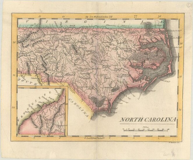
North Carolina. Mathew Carey, North Carolina, from American Pocket Atlas, 1814 (circa). Hand Color. This early map of the state details settlements, watersheds, topography, and the extensive wagon road system of the day. Locates many swampy areas along the coast including the Great Dismal Swamp, Alligator Swamp, and the Great Green Swamp. At lower left is an inset map of the western portion of the state. Engraved by J. Bower.
Dimensions: 5.6 x 7.4 in
Condition Report: On a bright sheet with professional repairs to a couple of small centerfold separations and tiny edge tears confined to the top blank margin. Grade: B+
View it on
Estimate
Time, Location
Auction House
North Carolina. Mathew Carey, North Carolina, from American Pocket Atlas, 1814 (circa). Hand Color. This early map of the state details settlements, watersheds, topography, and the extensive wagon road system of the day. Locates many swampy areas along the coast including the Great Dismal Swamp, Alligator Swamp, and the Great Green Swamp. At lower left is an inset map of the western portion of the state. Engraved by J. Bower.
Dimensions: 5.6 x 7.4 in
Condition Report: On a bright sheet with professional repairs to a couple of small centerfold separations and tiny edge tears confined to the top blank margin. Grade: B+


