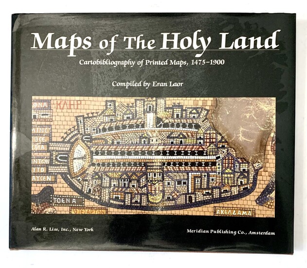
Maps of the Holy Land: Cartobibliography of Printed Maps, 1475-1900 by Eran Laor
Maps of the Holy Land: Cartobibliography of Printed Maps, 1475-1900
by Eran Laor
Alan R. Liss, Inc., NYC/Meridian Pub Co, 1986.
a comprehensive and scholarly cartobibliography of printed maps of the Holy Land. For many centuries, the Holy Land was the most important and prominent subject of mapmaking. The Hebrews acquired the art of surveying during their exile in Egypt--and the scriptural account of the apportioning of the Promised Land among the tribes is thought to be the first literary evidence of mapmaking in the early history of mankind. This magnificent collection ranges from the first printed map in the 1475 edition of the Rudimentum Novitorum via the extensive collection of Ptolemaic maps and the maps produced in Europe in the 17th and 18th centuries to the surveys of the 20th century. The catalog is arranged alphabetically by author. A general index of personal names and a chronological index facilitate identification of maps by collectors and librarians. The volume's 24 color reproductions and over 50 illustrations highlight the entries, of which there are over 1000, and each entry is accompanied by critical notes explaining its history and importance.. First Edition.
hardcover with DJ
198 pp.
26x32 cm
good condition
View it on
Sale price
Estimate
Reserve
Time, Location
Auction House
Maps of the Holy Land: Cartobibliography of Printed Maps, 1475-1900
by Eran Laor
Alan R. Liss, Inc., NYC/Meridian Pub Co, 1986.
a comprehensive and scholarly cartobibliography of printed maps of the Holy Land. For many centuries, the Holy Land was the most important and prominent subject of mapmaking. The Hebrews acquired the art of surveying during their exile in Egypt--and the scriptural account of the apportioning of the Promised Land among the tribes is thought to be the first literary evidence of mapmaking in the early history of mankind. This magnificent collection ranges from the first printed map in the 1475 edition of the Rudimentum Novitorum via the extensive collection of Ptolemaic maps and the maps produced in Europe in the 17th and 18th centuries to the surveys of the 20th century. The catalog is arranged alphabetically by author. A general index of personal names and a chronological index facilitate identification of maps by collectors and librarians. The volume's 24 color reproductions and over 50 illustrations highlight the entries, of which there are over 1000, and each entry is accompanied by critical notes explaining its history and importance.. First Edition.
hardcover with DJ
198 pp.
26x32 cm
good condition


