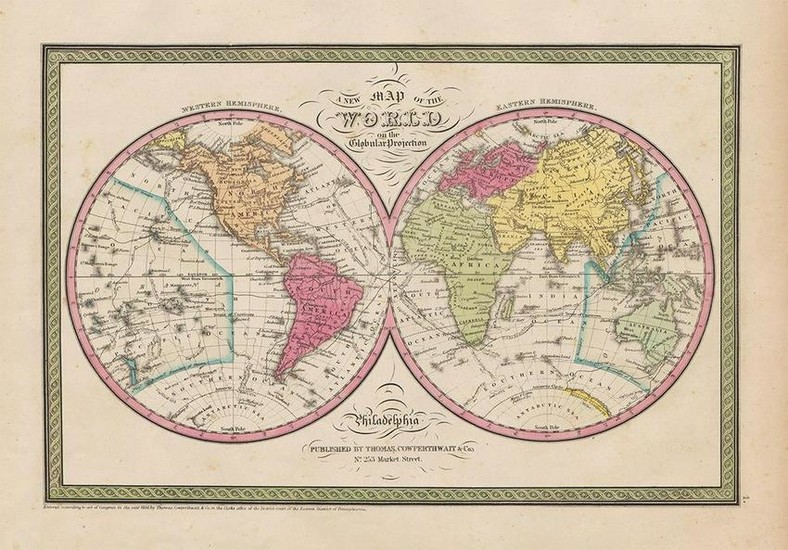
Mitchell Map of the World, 1850
Beautiful hand colored map of the world originally created by S. Augustus Mitchell in 1850. Thomas, Cowperthwait & Co. bought out Mitchell in 1850. They published this map in 1853. Shows the world on hemispherical projection and offers a fascinating snapshot of the world during a period of rapid globalization and discovery. The coast of Antarctica is drawn in sketchily, based upon early expeditions. The map is color coded according to continents with counties named but their boundaries not defined. Various important cities, rivers, islands, mountain ranges, and several other topographical details are noted. Very light and tiny spots of foxing, mostly in margins. 9.5 x 14.25.
Reserve: $75.00
Shipping:
Domestic: Flat-rate of $6.00 to anywhere within the contiguous U.S.
International: Foreign shipping rates are determined by destination.
Combined shipping: Please ask about combined shipping for multiple lots before bidding.
Location: This item ships from Ohio
Your purchase is protected:
Photos, descriptions, and estimates were prepared with the utmost care by a fully certified expert and appraiser. All items in this sale are guaranteed authentic.
In the rare event that the item did not conform to the lot description in the sale, Jasper52 specialists are here to help. Buyers may return the item for a full refund provided you notify Jasper52 within 5 days of receiving the item.
Condition Report: Very good minus
View it on
Estimate
Time, Location
Auction House
Beautiful hand colored map of the world originally created by S. Augustus Mitchell in 1850. Thomas, Cowperthwait & Co. bought out Mitchell in 1850. They published this map in 1853. Shows the world on hemispherical projection and offers a fascinating snapshot of the world during a period of rapid globalization and discovery. The coast of Antarctica is drawn in sketchily, based upon early expeditions. The map is color coded according to continents with counties named but their boundaries not defined. Various important cities, rivers, islands, mountain ranges, and several other topographical details are noted. Very light and tiny spots of foxing, mostly in margins. 9.5 x 14.25.
Reserve: $75.00
Shipping:
Domestic: Flat-rate of $6.00 to anywhere within the contiguous U.S.
International: Foreign shipping rates are determined by destination.
Combined shipping: Please ask about combined shipping for multiple lots before bidding.
Location: This item ships from Ohio
Your purchase is protected:
Photos, descriptions, and estimates were prepared with the utmost care by a fully certified expert and appraiser. All items in this sale are guaranteed authentic.
In the rare event that the item did not conform to the lot description in the sale, Jasper52 specialists are here to help. Buyers may return the item for a full refund provided you notify Jasper52 within 5 days of receiving the item.
Condition Report: Very good minus


