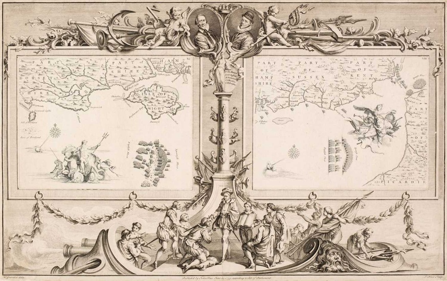
Pine (John), Two charts (on one sheet) showing the progress of the Spanish Armada, 1739
Pine (John). Two sea charts (on one sheet) originally published in 'The Tapestry Hangings of the House of Lords, Representing the Several Engagements between the English and Spanish Fleets, in the Ever Memorable Year MDLXXXVII ..., London: John Pine, 1739, two engraved sea charts (numbers VII & VIII) of the English Channel from the Isle of Wight to Dover, showing the progress of the Spanish Armada and the deployment of the English fleet, after H. Gravelot, each map displayed within highly decorative borders, the maps printed in blue, the borders in black, trimmed to the plate mark and laid on later paper, 380 x 60 mm, together with Mackenzie (Lt. Murdoch). Survey of the South Coast of England from St. Albans Head to Abbotsbury, 1787, uncoloured engraved sea chart centred on Portland Bill, later pencil marginalia, slight staining, 635 x 950 mm, with Depot de la Marine (publishers). Angleterre (Côte Sud) de Portland a Portsmouth..., 1865, uncoloured engraved sea chart centred on the Isle of Wight, one short closed tear, slight staining, 445 x 640 mm, with another 11 uncoloured late 19th & early 20th-century Admiralty sea charts, primarily of the south coast of England and the east coast of Ireland, various sizes and condition (Quantity: 14)
[ translate ]View it on
Estimate
Time, Location
Auction House
Pine (John). Two sea charts (on one sheet) originally published in 'The Tapestry Hangings of the House of Lords, Representing the Several Engagements between the English and Spanish Fleets, in the Ever Memorable Year MDLXXXVII ..., London: John Pine, 1739, two engraved sea charts (numbers VII & VIII) of the English Channel from the Isle of Wight to Dover, showing the progress of the Spanish Armada and the deployment of the English fleet, after H. Gravelot, each map displayed within highly decorative borders, the maps printed in blue, the borders in black, trimmed to the plate mark and laid on later paper, 380 x 60 mm, together with Mackenzie (Lt. Murdoch). Survey of the South Coast of England from St. Albans Head to Abbotsbury, 1787, uncoloured engraved sea chart centred on Portland Bill, later pencil marginalia, slight staining, 635 x 950 mm, with Depot de la Marine (publishers). Angleterre (Côte Sud) de Portland a Portsmouth..., 1865, uncoloured engraved sea chart centred on the Isle of Wight, one short closed tear, slight staining, 445 x 640 mm, with another 11 uncoloured late 19th & early 20th-century Admiralty sea charts, primarily of the south coast of England and the east coast of Ireland, various sizes and condition (Quantity: 14)
[ translate ]


