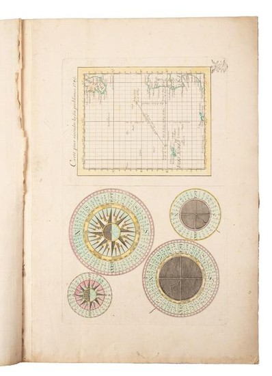
Rare German marine atlas of the world, 1749
Heading:
Author: Broukner, Isaac
Title: Nouvel atlas de Marine composé d'une carte générale, et de XII cartes particulières, qui représentent le globe terrestre jusqu'au 82e degré du côté du nord, et jusqu'au 60e du côté du Sud. Le tout dressé sur les observations les plus nouvelles et les plus approuvées...
Place Published: Berlin
Publisher:
Date Published: 1749
Description:
With double-page engraved World chart serving as sheet index, 12 double-page engraved charts, 1 full-page chart of Western Approaches incorporating 4 compass roses, all hand-colored in outline. (Folio) 47.2x32.5 cm (18½x12¾"), period leather-backed marbled boards.
Rare German marine atlas - most of the maps seem to derive from Bellin's Map of the World of 1748. Bellin's map and this one are the first to show a cartographic reference to Bering's second voyage, although grossly distorted. Each map with a small ink stamp of crowned eagle in lower right corner, identified as a Prussian revenue stamp. OCLC/WorldCat lists a dozen or so maps from this atlas, but has no listings of the atlas itself.
Condition Report: Covers worn, detached, spine strip perished; maps a little dusty in places, light staining in some lower margins; internally very good.
View it on
Sale price
Estimate
Time, Location
Auction House
Heading:
Author: Broukner, Isaac
Title: Nouvel atlas de Marine composé d'une carte générale, et de XII cartes particulières, qui représentent le globe terrestre jusqu'au 82e degré du côté du nord, et jusqu'au 60e du côté du Sud. Le tout dressé sur les observations les plus nouvelles et les plus approuvées...
Place Published: Berlin
Publisher:
Date Published: 1749
Description:
With double-page engraved World chart serving as sheet index, 12 double-page engraved charts, 1 full-page chart of Western Approaches incorporating 4 compass roses, all hand-colored in outline. (Folio) 47.2x32.5 cm (18½x12¾"), period leather-backed marbled boards.
Rare German marine atlas - most of the maps seem to derive from Bellin's Map of the World of 1748. Bellin's map and this one are the first to show a cartographic reference to Bering's second voyage, although grossly distorted. Each map with a small ink stamp of crowned eagle in lower right corner, identified as a Prussian revenue stamp. OCLC/WorldCat lists a dozen or so maps from this atlas, but has no listings of the atlas itself.
Condition Report: Covers worn, detached, spine strip perished; maps a little dusty in places, light staining in some lower margins; internally very good.


