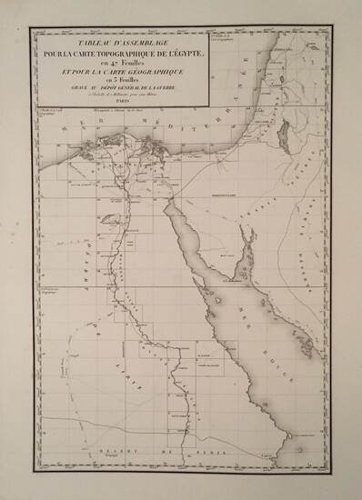
Carte topographique de l'Egypte et de plusieurs partis des pays limitrophes, levée pendant l'expédition de l'armée française, par les ingéniuers-géographes, les officiers du génie militaire et les ingénieurs des ponts et chausées ; assujettie aux...
By Jacotin, Pierre
Folio: 50 plates. (70 x 110 cm) An unbound and unfolded copy of the topographic maps made after Napoleon's expedition in Egypt. Complete with the plate listing the engineers, and all maps present (41 plates showing 47 maps). Edges of sheets show some minor splits, chips, outer edges of margins toned and slightly soiled, not affecting the printed maps. Housed in a custom made cloth covered box by John Demerritt.First printing of this monumental map, one of the most important French cartographic publications of the nineteenth century, serving as the primary atlas for Description de l'Égypte ou Recueil des observations et des recherches qui ont été faites en Egypte pendant l'expédition de l'armée française (1809-1813); 1817-[1830]. Pierre Jacotin, the chief engineer of the military force led by Napoleon, used modern methods of triangulation to survey and map Egypt during the Emporer s campaign. The map was ready by 1807, but strategic reasons prevented its publication under the Empire.
Publication year: 1818
Vendor: Gerald W. Cloud Rare Books
Buy Now on
By Jacotin, Pierre
Folio: 50 plates. (70 x 110 cm) An unbound and unfolded copy of the topographic maps made after Napoleon's expedition in Egypt. Complete with the plate listing the engineers, and all maps present (41 plates showing 47 maps). Edges of sheets show some minor splits, chips, outer edges of margins toned and slightly soiled, not affecting the printed maps. Housed in a custom made cloth covered box by John Demerritt.First printing of this monumental map, one of the most important French cartographic publications of the nineteenth century, serving as the primary atlas for Description de l'Égypte ou Recueil des observations et des recherches qui ont été faites en Egypte pendant l'expédition de l'armée française (1809-1813); 1817-[1830]. Pierre Jacotin, the chief engineer of the military force led by Napoleon, used modern methods of triangulation to survey and map Egypt during the Emporer s campaign. The map was ready by 1807, but strategic reasons prevented its publication under the Empire.
Publication year: 1818
Vendor: Gerald W. Cloud Rare Books


