Charles Smith's County Atlas: A Complete Set of County Maps of England Second Edition 1808
By Charles Smith
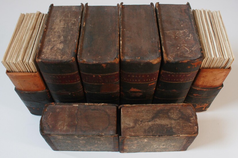
This set comprises of Charles Smith's English Counties along with two maps of Wales from the same date and a second edition map of England and Wales from 1814. Arguably one of the finest drawn and printed maps from this period and certainly comparable to Cary. All maps mounted in sections on linen. Full hand-colouring. Counties drawn to various scales. Details include main (turnpike) roads; parks; canals; churches and basic hachuring. The maps also reference longitude relative to Greenwich: an unusual feature at this time. The majority of maps are in wonderful condition with minimal wear, tight folds and no extraneous marking. The maps are housed in contemporary purpose-made solander boxes. All boxes show wear to the external surfaces, especially to front where the spines are worn with the leather dried, cracked and peeling. However, the insides of the boxes are in lovely condition: dry, no staining and little wear. 46 maps: 1x England; 2x Wales (North & South); 43x Counties (40 Counties [Yorkshire spread over 4 maps]) County scales range between 7/8th mile to 1" and 4 miles to 1". Accreditations under compass point (Wales and Yorkshire considered to be one map each): 27 maps credited to Jones and Smith at Pentonville; 6 at the Strand address; 6 with no stated address and 3 credited to Smith, Jones & Bye at the Strand address. 32 maps graded as VG+ (with very minimal wear/marking); 11 (slight wear and marking); 1 VG- (some sign of use); 1 G+ (Clear wear and marking); 1 G (Generally worn and marked). An exceptionally rare and complete set. Postage outside the UK will incur extra costs, please email for details. Descriptions of each map available on request, along with further details/images. (184bYsb)
Published by: Charles Smith, 1808
Vendor: Morning Mist Books and Maps
Buy Now on
By Charles Smith
This set comprises of Charles Smith's English Counties along with two maps of Wales from the same date and a second edition map of England and Wales from 1814. Arguably one of the finest drawn and printed maps from this period and certainly comparable to Cary. All maps mounted in sections on linen. Full hand-colouring. Counties drawn to various scales. Details include main (turnpike) roads; parks; canals; churches and basic hachuring. The maps also reference longitude relative to Greenwich: an unusual feature at this time. The majority of maps are in wonderful condition with minimal wear, tight folds and no extraneous marking. The maps are housed in contemporary purpose-made solander boxes. All boxes show wear to the external surfaces, especially to front where the spines are worn with the leather dried, cracked and peeling. However, the insides of the boxes are in lovely condition: dry, no staining and little wear. 46 maps: 1x England; 2x Wales (North & South); 43x Counties (40 Counties [Yorkshire spread over 4 maps]) County scales range between 7/8th mile to 1" and 4 miles to 1". Accreditations under compass point (Wales and Yorkshire considered to be one map each): 27 maps credited to Jones and Smith at Pentonville; 6 at the Strand address; 6 with no stated address and 3 credited to Smith, Jones & Bye at the Strand address. 32 maps graded as VG+ (with very minimal wear/marking); 11 (slight wear and marking); 1 VG- (some sign of use); 1 G+ (Clear wear and marking); 1 G (Generally worn and marked). An exceptionally rare and complete set. Postage outside the UK will incur extra costs, please email for details. Descriptions of each map available on request, along with further details/images. (184bYsb)
Published by: Charles Smith, 1808
Vendor: Morning Mist Books and Maps


