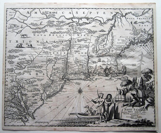
Novi Belgii qoud nunc Novi Jorck vocatur, Novae Angliae & Partis Virginiae Accuratissima et Novissima Delineatio.
By Montanus, Arnoldus (c1625-1683)
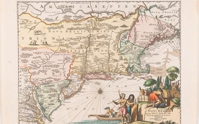
copper engraved map; overall 31 x 37,5 cm; image 29 x 36,5 cm. fold as issued; some creases; small margins all around; evenly toned; o/w vg cond. - Beautifully engraved and decorated map of the East coast from Maine to Virginia, by Montanus from his work De Nieuwe en Onbekende Weereld: of Beschryving van America which was considered to be the first encyclopedia of the Americas. This is one of the earliest maps to show the Plymouth settlement. Notable is Manhattan being portrait as an island. Throughout, the map is embellished with indigenous animals, including a turkey. The elaborate cartouche shows indigenous people fishing and hunting. The new English colonies, ie New York and New Jersey of are being mentioned. - The map was printed by Jacob de Meurs. The entire work was intended to be published in 1670 but due to lack of sufficient information, it was finally published in 1671. This map is part of the Jansson-Visscher series of maps with derivations from Blaeu s map of Nova Belgica of 1635. - Burden 411, 1st state. McCorkle
Published by: Amsterdam, 1671
Vendor: Angelika C. J. Friebe Ltd. - MapWoman
Buy Now on
By Montanus, Arnoldus (c1625-1683)
copper engraved map; overall 31 x 37,5 cm; image 29 x 36,5 cm. fold as issued; some creases; small margins all around; evenly toned; o/w vg cond. - Beautifully engraved and decorated map of the East coast from Maine to Virginia, by Montanus from his work De Nieuwe en Onbekende Weereld: of Beschryving van America which was considered to be the first encyclopedia of the Americas. This is one of the earliest maps to show the Plymouth settlement. Notable is Manhattan being portrait as an island. Throughout, the map is embellished with indigenous animals, including a turkey. The elaborate cartouche shows indigenous people fishing and hunting. The new English colonies, ie New York and New Jersey of are being mentioned. - The map was printed by Jacob de Meurs. The entire work was intended to be published in 1670 but due to lack of sufficient information, it was finally published in 1671. This map is part of the Jansson-Visscher series of maps with derivations from Blaeu s map of Nova Belgica of 1635. - Burden 411, 1st state. McCorkle
Published by: Amsterdam, 1671
Vendor: Angelika C. J. Friebe Ltd. - MapWoman


