Slater (Isaac, publisher). Slater's New British Atlas..., circa 1850
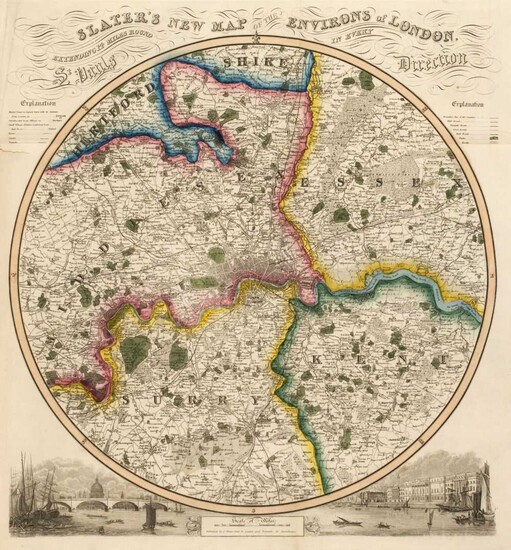
Slater (Isaac, publisher). Slater's New British Atlas, Comprising the Counties of England (upon which are laid down all the Railways completed and in Progress) with Separate Large Sheet Maps of England and Wales, Scotland and Ireland and a Circular one of the Country round London..., Isaac Slater (Late Pigot & Slater) and others, circa 1850, decorative title, contents and seven distance and mileage tables, three large engraved folding maps of England & Wales, Scotland and Ireland, each with contemporary hand colouring and each laid on linen, slight wear where old folds cross, 39 (complete as list) engraved county maps, all with contemporary outline colouring, including one folding (Yorkshire), some marginal staining, dust and finger soiling throughout, the map of Warwickshire, with the margins crudely strengthened with tape, large circular map of London and its environs bound at rear, marbled endpapers, rear endpaper with long repaired closed tear, bookplate of Thomas King, contemporary half calf, re-backed but retaining the original boards, heavily rubbed and worn, folio
(Qty: 1)
Chubb CCCCXXIX. The distance tables reference the population census of 1841, however, the map of Scotland is dated 1850 and the map of Ireland 1845.
View it on
Estimate
Time, Location
Auction House
Slater (Isaac, publisher). Slater's New British Atlas, Comprising the Counties of England (upon which are laid down all the Railways completed and in Progress) with Separate Large Sheet Maps of England and Wales, Scotland and Ireland and a Circular one of the Country round London..., Isaac Slater (Late Pigot & Slater) and others, circa 1850, decorative title, contents and seven distance and mileage tables, three large engraved folding maps of England & Wales, Scotland and Ireland, each with contemporary hand colouring and each laid on linen, slight wear where old folds cross, 39 (complete as list) engraved county maps, all with contemporary outline colouring, including one folding (Yorkshire), some marginal staining, dust and finger soiling throughout, the map of Warwickshire, with the margins crudely strengthened with tape, large circular map of London and its environs bound at rear, marbled endpapers, rear endpaper with long repaired closed tear, bookplate of Thomas King, contemporary half calf, re-backed but retaining the original boards, heavily rubbed and worn, folio
(Qty: 1)
Chubb CCCCXXIX. The distance tables reference the population census of 1841, however, the map of Scotland is dated 1850 and the map of Ireland 1845.


