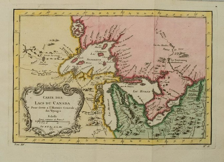
1754 Bellin Map of the Great Lakes Region -- Carte des
Title: 1754 Bellin Map of the Great Lakes Region -- Carte des Lacs du Canada pour Servir a l'Histoire Generale des Voyages
Date: 1754 c., Paris
Medium: JBellin
Size: 7.7 X 11.4 in.
Additional Information: This is an excellent map detailing the Great Lakes from the French and Indian War period.Lakes Erie and Ontario are relatively accurately defined and the spurious islands in Lake Huron shown historically have been eliminated. However, several large, non-existing islands still remain in Lake Superior, including I. Minong and I. Pontchartrain. The Michigan peninsula is misshaped with a large mountain range down its center.Numerous forts are shown, including S. Jgnace, Niagara, des Miamis, and Toronto, etc. The ornate rococo title cartouche is draped with ivy.
Reserve: $420.00
Shipping:
Domestic: Flat-rate of $17.00 to anywhere within the contiguous U.S.
International: Foreign shipping rates are determined by destination.
Combined shipping: Please ask about combined shipping for multiple lots before bidding.
Location: This item ships from Ohio.
Your purchase is protected:
Photos, descriptions, and estimates were prepared with the utmost care by a fully certified expert and appraiser. All items in this sale are guaranteed authentic.
In the rare event that the item did not conform to the lot description in the sale, Jasper52 specialists are here to help. Buyers may return the item for a full refund provided you notify Jasper52 within 5 days of receiving the item.
Condition Report: Very Good.On laid paper.A few small stain and foxing spots.Issued folds. Nice hand color.
View it on
Sale price
Estimate
Time, Location
Auction House
Title: 1754 Bellin Map of the Great Lakes Region -- Carte des Lacs du Canada pour Servir a l'Histoire Generale des Voyages
Date: 1754 c., Paris
Medium: JBellin
Size: 7.7 X 11.4 in.
Additional Information: This is an excellent map detailing the Great Lakes from the French and Indian War period.Lakes Erie and Ontario are relatively accurately defined and the spurious islands in Lake Huron shown historically have been eliminated. However, several large, non-existing islands still remain in Lake Superior, including I. Minong and I. Pontchartrain. The Michigan peninsula is misshaped with a large mountain range down its center.Numerous forts are shown, including S. Jgnace, Niagara, des Miamis, and Toronto, etc. The ornate rococo title cartouche is draped with ivy.
Reserve: $420.00
Shipping:
Domestic: Flat-rate of $17.00 to anywhere within the contiguous U.S.
International: Foreign shipping rates are determined by destination.
Combined shipping: Please ask about combined shipping for multiple lots before bidding.
Location: This item ships from Ohio.
Your purchase is protected:
Photos, descriptions, and estimates were prepared with the utmost care by a fully certified expert and appraiser. All items in this sale are guaranteed authentic.
In the rare event that the item did not conform to the lot description in the sale, Jasper52 specialists are here to help. Buyers may return the item for a full refund provided you notify Jasper52 within 5 days of receiving the item.
Condition Report: Very Good.On laid paper.A few small stain and foxing spots.Issued folds. Nice hand color.


