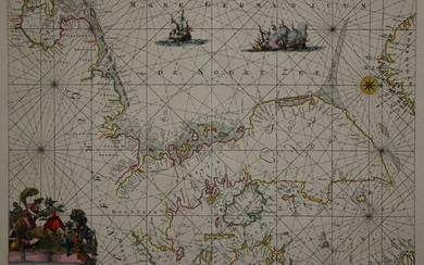
De Wit's striking world map c.1670
Heading:
Author: Wit, Frederick de
Title: Nova Orbis Tabula, in Lucem Edita
Place Published: Amsterdam
Publisher:
Date Published: c.1670
Description:
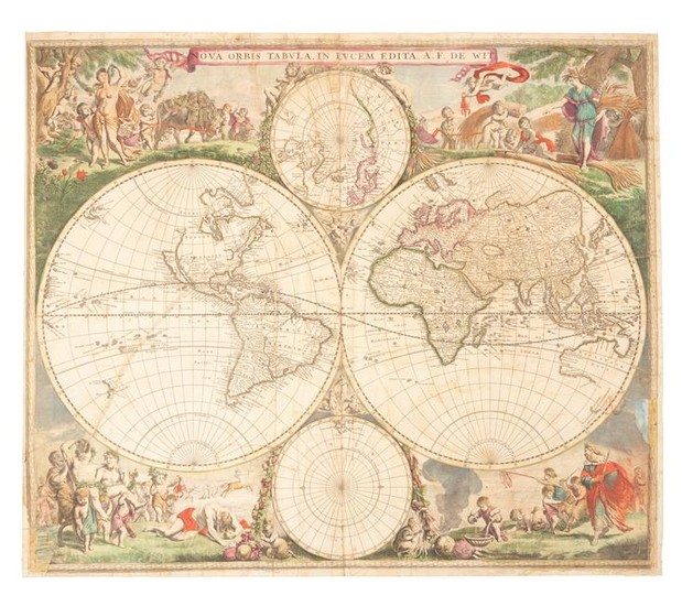
Copper-engraved double-hemisphere map of the world, hand-colored in outline, surrounded by hand-colored pictorial engravings. 47.8x56.5 cm (18¾x22¼").
Striking world map, corners are filled with images of the seasons, the zodiac, and the elements, all combined within four well-composed vignettes. In North America, the Great Lakes appear as one large semi-circle with an open western end, and the island of California is shown on the Briggs model with a flat northern coast, and a portion of Anian appears in the Pacific Northwest. South America has the mythical L. Parime astride the equator, with the imaginary golden city of Manoa on its shores. A partial coastline for Australia is shown, and both New Zealand and Tasmania are indicated by only one stretch of coastline. The inset of the North Pole shows Hudson Bay with two southern bays, and the inset of the South Pole is nearly blank save for the very tip of South America and Tierra del Fuego. This is the second state of the first plate, with cherubs in the cusps but without the appearance of Nova Guinea and Quiri Regio in the western hemisphere.
Condition Report: Fairly worn, long tear from lower left through the Pacific, several smaller tears and some creasing, all repaired with paper strips and backing on the verso; lower left corner replaced with rather crude infill; some soiling; good only, but overall still an attractive example, sold as is.
View it on
Sale price
Estimate
Time, Location
Auction House
Heading:
Author: Wit, Frederick de
Title: Nova Orbis Tabula, in Lucem Edita
Place Published: Amsterdam
Publisher:
Date Published: c.1670
Description:
Copper-engraved double-hemisphere map of the world, hand-colored in outline, surrounded by hand-colored pictorial engravings. 47.8x56.5 cm (18¾x22¼").
Striking world map, corners are filled with images of the seasons, the zodiac, and the elements, all combined within four well-composed vignettes. In North America, the Great Lakes appear as one large semi-circle with an open western end, and the island of California is shown on the Briggs model with a flat northern coast, and a portion of Anian appears in the Pacific Northwest. South America has the mythical L. Parime astride the equator, with the imaginary golden city of Manoa on its shores. A partial coastline for Australia is shown, and both New Zealand and Tasmania are indicated by only one stretch of coastline. The inset of the North Pole shows Hudson Bay with two southern bays, and the inset of the South Pole is nearly blank save for the very tip of South America and Tierra del Fuego. This is the second state of the first plate, with cherubs in the cusps but without the appearance of Nova Guinea and Quiri Regio in the western hemisphere.
Condition Report: Fairly worn, long tear from lower left through the Pacific, several smaller tears and some creasing, all repaired with paper strips and backing on the verso; lower left corner replaced with rather crude infill; some soiling; good only, but overall still an attractive example, sold as is.
