Carte Du Grand Ocean Ou Mer Du Sud. Atlas Du Voyage De La Perouse No. 3 Map
By TARDIEU, P F
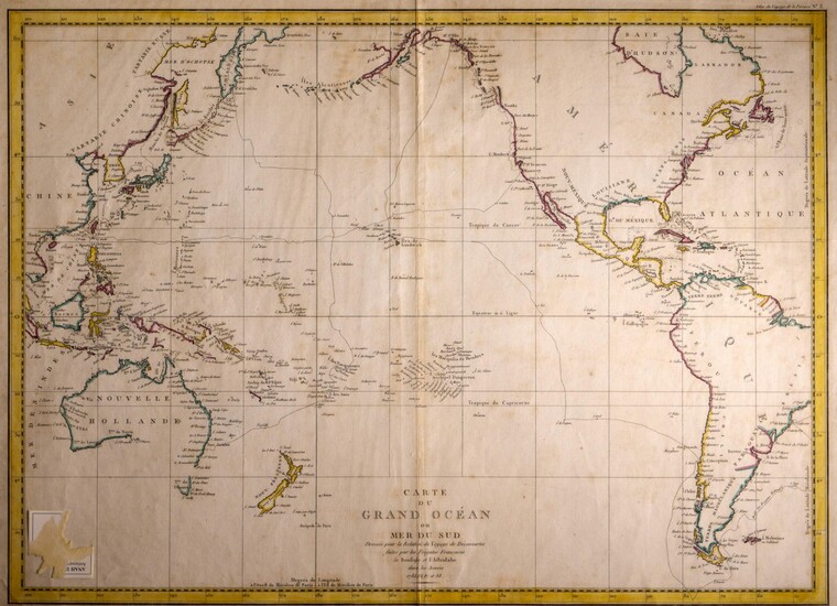
c. 1789. Original hand-coloured engraved map of the Grand Ocean or South Sea made by the French Frigates Boussole & Astrolabe in the years 1785, 86, 87 & 88. From the Atlas du Voyage de la Perouse. Plate No. 3. Free-floating & protected by mylar. Size: 760mm x 535mm. Some light foxing & fold mark to centre but else a very fine map
Published by: Paris, 1789
Vendor: Anah Dunsheath RareBooks ABA ANZAAB ILAB
Buy Now on
By TARDIEU, P F
c. 1789. Original hand-coloured engraved map of the Grand Ocean or South Sea made by the French Frigates Boussole & Astrolabe in the years 1785, 86, 87 & 88. From the Atlas du Voyage de la Perouse. Plate No. 3. Free-floating & protected by mylar. Size: 760mm x 535mm. Some light foxing & fold mark to centre but else a very fine map
Published by: Paris, 1789
Vendor: Anah Dunsheath RareBooks ABA ANZAAB ILAB


